What You Need to Know About Traveling to Kathmandu, Nepal

Report from 5/29/18

I woke up this morning feeling a bit better than I did when I first arrived. The excitement returned, and I slept off some of the anxiety that accumulated. However, that does not mean that anything changed Kathmandu is honestly a city that is very loud, dirty, and traffic is absolute nonsensical chaos. I knew all this going in, but it doesn’t matter how much prep and research you put into it, nothing will really prepare you for your first time alone in a 3rd world country. And that is exactly what I am going to debrief you on today: The ugly, and the beautiful.

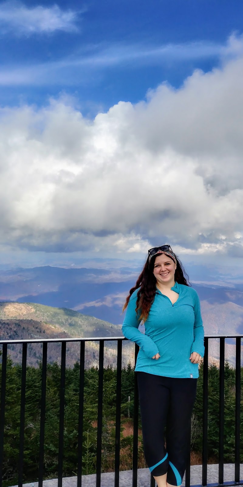
This morning I met my one other climbing partner that signed up for the same date block as I did. I do feel better that I’m not alone. Besides us two, our team will consist of 2 guides and 1 porter. There will also be a cook and staff up at Island Peak Basecamp. After our briefing meeting this morning at the Himalayan Glacier Office, our awesome guide took us to a few iconic sites. (I will tell you his name when I figure out how to spell it).  As excited as I was walking through the beautiful streets of Thamel that morning, here is where it gets interesting and my blood pressure probably shot through the roof: We had to take a taxi… in daytime Kathmandu traffic…

First off, I would like to say that after what I survived today, climbing a giant mountain is going to be easy! Now, you’re probably asking yourself “wait, what?!”. Let me explain… I am a very anxious person. I like the mountains because of the solitude. I hike alone most of the time because I like the quiet, and peace that comes from being in those mountains. I love that I live with trail heads in my backyard. I HATE going into the city. It’s stressful, fast paced and crowded. I’m not a fan. Anytime there is some sort of event, or party or something that forces me to go into downtown Salt Lake, I cringe, I complain, and I get stressed out. I deal with it, and I’m just thankful I don’t live somewhere like New York City or LA. Kathmandu is a very crowded, and very densely populated city. For those at home Kathmandu Valley is much like Salt Lake Valley… only half the size and double the population.

So, I put a crazy amount of faith into this taxi driver as he drove us all over town. This is what I learned about Kathmandu Traffic:

  1. There are no rules of the road… not really anyway. There are lines on some streets, and there are these weird giant pillars in the middle of certain intersections, and occasionally you will see traffic cops helping move things along on the busiest streets, but really, there is nothing like you see back at home. No street signs, speed limits, not even stop lights! Everyone just kind of goes. 
  2. Nepali drivers are probably the best drivers in the world, and Utah drivers really are probably the worst. Despite the seemingly organized chaos on the streets of Kathmandu, Nepali drivers have mad skills. They have to be extremely attentive. It’s like you’re driving through a neighborhood and kids on both sides of the street are accidentally kicking their balls into traffic, constantly. They are also incredibly aggressive and assertive drivers. Now, I don’t mean angry or road rage-y, I mean they find any window of opportunity and take it. There is CONSTANT honking, flashing brights at each other and weaving around cars and bikes, but non of it is with hostility, it’s all done as almost like a note of “hey I’m here” to bigger cars or pedestrians. 
  3. Traffic RARELY comes to a standstill. In rush hour in Salt Lake, there are several areas of the Valley that come to a complete standstill. In Kathmandu, because everyone is forcing there way around everyone, traffic is always moving.
  4. Car accidents are rare and if there ever is a car accident, it’s usually not a big deal. We have a max speed limit of 80mph in Utah. People die… all the time. Wrecks at home are often horrific. Because of the attentiveness of everyone on a bike or in a little Suzuki driving around Kathmandu, nothing really ever happens. There appear to be close calls everywhere to the untrained eye, but once you figure out how it all sort of “works” you realize that’s normal traffic for them. 
  5. Cows chill in the road. So do goats and monkeys. 

Now for the cool part. The part everyone scrolls down past all the other stuff to read right?

First we went to the infamous Shree Pashupatinath Temple. This is the giant, iconic and recognizable Bhuddist Temple in Nepal. Back in 2016 when the earthquake hit, the top of the temple completely crumbled. They have since rebuilt it and the site looks as if there never was an earthquake. 

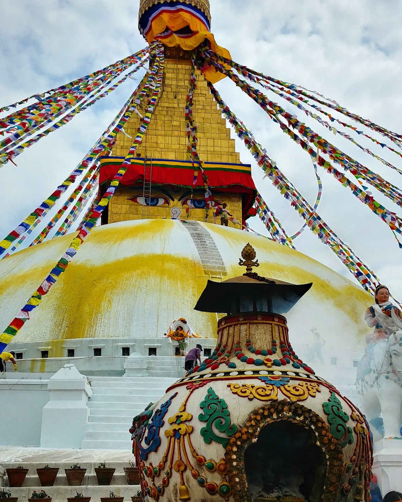
We circled around the temple taking a million pictures before heading to our next stop, Swayambhunath, also known as The Monkey Temple. This is where the internet sometimes gets confused. This is because the sites look very similar however the monkey temple is much, much smaller and has more architectural features. Many mistake Shee Pashupatinath for Swayambunath and vice versa. In fact, I myself thought that was the case. But names aren’t important, all that matters is the beauty that comes from these sites. It is indescribable. I had seen pictures of both, and for years I dreamed about it, but nothing compares to the real thing. The smell of incense in the air, prayers being offered, and despite the crowds, it is a peaceful place and completely worth the crazy drive.

A question I’m sure some are wondering, as I wondered myself, how is Nepal doing since the earthquake? Well, they are healing, but there is still a lot to be done. I’m sure I will see in the mountain villages later, as I have heard the status it is much worse , but in Kathmandu, the buildings that took the most damage were old, brick, and poorly structured. most of the city still stands. However, there are signs of damage and hurt everywhere still. as we drove around, there were lots that were still a pile of rubble that have yet to be rebuilt. Some sites were still in the rebuild process, many sidewalks and roads are still damaged, and there is a huge homeless problem. as we drove buy these beautiful temples, on the outside were dozens and dozens of people seeking sanctuary and refuge begging for rupees. It is a hard, sad, and humbling site to see, especially as I am there for leisure. The one thing to avoid is feeling guilty. Nepal thrives on tourism. By traveling to this country to visit, and showing interest in the historic sites, paying entry fees, paying permit fees for climbing, and buying local fare, that money helps their economy get back on track. I remember when the quake first happened, I wanted to jump on the first plane out here to help, but it wasn’t even aloud. Planes were grounded for days and no one was allowed into the country. Now, they appreciate the help, but they also just appreciate people coming to visit and taking an interest in their home country. Nepali pride is evident everywhere and as much as I enjoyed the temples in town, I cannot wait to see the mountains I came here for.

A Day in Singapore

Report from 5/28/18

Most people would freak at a 22 hour layover in a foreign country where leaving the airport requires you to obtain a visa. However, I had a blast!

Changi Airport is the BEST airport in the world, and I’m not just saying that. It has actually won “Best Airport in the World” for almost a decade straight! I arrived around 9pm Sunday night. Changi has transit hotels and lounges in every terminal so my first priority was finding one of the hotels and passing out. They charge by the hour to try to accommodate various flight schedules. I paid for 9 hours which ran be approximately $130USD. A little steeper than I would normally pay for a hotel but it was super nice! The only downside is I could not figure out how to adjust their thermostat so I kept waking up in a sweat. Singapore is so unbelievably humid and I sleep cold.

Anyways, woke up the next morning ready to explore. I had read about a free Singapore tour hosted by the airport that can be done without needing a visa so that was priority number 1. I found the registration booth, signed up and went and found some breakfast. The tour began at Merlion park where you get beautiful city views and of course get to take a picture with the infamous Merlion statue! We then drove through china town and little India and stopped in Maylay town where we got to see the beautiful mosque, wall art, and smell the delights of Ramadan festival foods. The night tours get to stop in the treetops garden, unfortunately the day tour does not, but I got to see a glimpse of it as we drove by.

Once I got back to the airport it was time for my own tour. My goal was to find and hit every garden. I hit all 3 of the main terminals but my all time favorite was the butterfly garden in terminal 3. I have never seen so many butterflies in my life!!

Singapore is known for being high end. People there fancy the “nice things” so Changi Airport is like a massive mall and all the shops are high end designers. But I’m not nor have I ever been interested in that kind of shopping. I found Singapore shops because I was in search of culture. Batik is the traditional garb of Singapore. Batik is the art of creating beautiful and intricate patterns in rich dyes. The Singapore Airlines flight attendants wear Batik as their uniform and I thought they were absolutely gorgeous and I wanted one. I literally had to buy the biggest size they had because they are sized for tiny Asian bodies, not broad shouldered, tall Americans. At least it fits!

After a long day of exploring I bid farewell to Singapore. My return layover will be much shorter and won’t allow as much time to explore. I arrived in Kathmandu last night to some immediate culture shock as it is a vastly different corner of the world. The city is loud, dirty, and traffic is absolute nonsensical chaos. I knew all this going in but it doesn’t matter how much prep and research you put into it, nothing will really prepare you for your first time alone in a 3rd world country. After a spike in anxiety, I got some sleep and am ready to face it head on because underneath all that are smells of incense, curry, and a culture I have loved and adored for years without ever even being here. Today we head to the main Himalayan Glacier Office and relax in town before we head to Lukla tomorrow. I am excited for what awaits me.

TRIP REPORT: Mount Mitchell (6,684′) – North Carolina’s High Point

Report from 11/19/17

Adventure and a wedding!

First off, a public congratulations to my sister Roxanne and her new hubby Joe on their wedding! I love you and I’m so proud of you!!!

Secondly, I will be honest, this is a short trip report. But you will soon understand why.

Rewind to about 2 days before I left for North Carolina. I was texting my sister and dad back and forth to figure out what exactly the plan was for the weekend. My sister and I had talked about going climbing together for her bachelorette party, and I was still waiting to get a confirmation from someone. I was due to land in North Carolina late Thursday night and would be in town all day Friday and Saturday for the wedding. Once I found out that we would have time to climb Friday morning and the rest of the day I would be free to do my own thing, I decided to start looking up things to do not having a clue of what was out there besides lakes, trees, trees, and more trees. I knew my sister lived fairly close to the Appalachians, so I decided to look up hikes in the area. I came to find out that North Carolina’s high point, Mount Mitchell, was only about a 2 1/2 drive from my hotel! So that is exactly what I did…

I took my little sister climbing,

Then, I drove out to Mount Mitchell, where I “hiked” the .25mi paved trail to the top; a mere 6,684’…

Was I dissapointed considering the fact that I live at 5,000′, and I have 11,000’+ peaks at my doorstep? Not Exactly. The views were beautiful, and the Autumn drive was incredibly colorful with the mass amounts of trees. It was a cool peak to check off my list, and the perfect way for someone like me to spend my short weekend in town!

North Carolina View (East)
Tennessee View (West)

As you can imagine, Saturday was wedding day! I wish I could’ve stayed longer to visit my sister, but I am glad that I was at least able to make it for the wedding!

TRIP REPORT: Cardiff Peak, UT (10,277′) – Snow Climb

Report from 4/5/17

Spring is FINALLY here, and I am on Spring Break!

I couldn’t wait to get out and do some climbing. I had been hiking pretty regularly at lower elevations since things had warmed up, but I had been dying to hike and climb in the snow. bad weather nearly every weekend made it difficult with student teaching, so after a nice cold front came through and stiffened up all the snow, I figured I had to get out on the hill while I had the chance!

My first choice for my first big training climb of the season was Mount Superior at 11,132′ but as you will read, that did not go according to plan, which happens. Superior is known in Utah for having the most avalanche activity so winter ascents can only really be attempted in prime conditions.

Superior overlooks both Alta and Snowbird Ski Resorts from the other side of Little Cottonwood Canyon. I have climbed it during summer months, the East ridge from Cardiff pass is rated a class 2. Starting from Alta, it is about a 5 1/2 mile hike round trip with an elevation gain of around 2500ft.

My original plan was to get up at 6:30, and start hiking by 7:30 in the morning. …I did not sleep well last night so by the time my alarms went off, I did not want to get up…. I woke up at around 8, checked the temperature up the canyon to find temperatures were still below freezing, so I left and started hiking just before 9am. Right off the bat, the snow was icy and firm. I kept up what I like to call “dry speed” which is the speed in which I can hike on dry dirt trail, so I compare my speed to my past summer climbs.

As I got to Cardiff pass and started up the ridge, the snow was INCREDIBLY soft. I would step and sink into thigh deep powder and my climbing speed basically came to a crawl. It took me 45 minutes to climb 250 vertical feet…. it was frustrating. Every step forward was a step backward. As I came up near the summit of Cardiff Peak, I took one look at Superior and sighed. I had a mile left…. a very long mile. Looking along the ridge, it seemed to be the same powdery deep frustrating snow I had just been trudging through and I would take me an eternity. The temperature was rising quickly, I was running out of time as well before I needed to be home, so I turned off the ridge trail to climb the final 20 feet to the summit of Cardiff instead. Superior or bust? Definitely a bust… but not a complete loss.

I still got a great “first climb of the season” workout, and great pictures of the amazing views from Cardiff.

Plenty more training climbs to come this Spring. ‘Til next time!

TRIP REPORT: Mount Lady Washington, CO (13,281′)

Report from 8/20/16

The Overlooked 13er…

I know I wasn’t planning on any cool peaks during my week off, but it happened anyway! After all, what is a vacation without a massive mountain to climb? *winky-smiley-face*

Mount Lady Washington is located in Rocky Mountain National Park. It stands front-right of  Long’s Peak which is the park’s only 14er. This little pile of rocks constantly gets overlooked since a large majority of the people who hike this trail go to hike Long’s Peak.

L to R: Mount Meeker, Long’s Peak, Mount Lady Washington

However, MLW has literally the most sunning view I have ever seen in my life. It is one I highly reccomend if you are visiting RMNP. (See what I did there? I got lazy and just used letters…) Anyway, Mount Lady Washington, also known as “MLW”, “Lady”, “Lady Washington”, or “#5 in the Grand Slam”. It stands at 13,281 feet above sea level. It’s not nearly as impressive in size as its 14,261 foot neighbor, but it has very understated qualities.

I started my hike at 4:30am however the trail was not scarce. Because of the unpredictable weather the Colorado 14ers create because of their height, anyone wishing for a successful summit of Long’s has to leave in the middle of the night. I passed many hikers who were on their way up to Long’s Peak, and as I asked in passing to each group I went by, not a single person was hiking anything else. 

First light on the trio. (MLW is the pile of rocks on the right)

I reached Chasm Junction 3 1/2 miles from the trailhead just before sunrise. I took a break here and waited for the stunning view. Soon after the mountain turned pink, the orange, I headed up the trail less than 1/4 mile more before taking a hard left. There is no maintained trail on MLW and there are basically two main ways people reach the top. One is directly up the front, east face. It is a steep 2,000 foot climb in class 2 tundra/class 3 scrambling mix. The other is to hike to the Boulder Field camping area another mile and a half up the trail (also known as basecamp to Long’s), then to follow the Northwest ridge. I decided on the shorter steeper route for my ascent, and the longer, flatter route for the way down to save my knees. It was steep, slow going, and strenuous boulder hopping that seemed to never end. I was literally the ONLY person on that mountain all morning and I honestly doubt anyone else summited after I did. No one else that I passed on the way down was planning on MLW, and if there was anyone attempting the Grand Slam that day, they would’ve gotten rained out since it’s the last peak in the series and it began to rain just after I made it back to the trail head. 

my line up MLW

When I finally made it over that ridge, I was immediately in awe. The summit view, like I mentioned before, was absolutely incredible. I have climbed Long’s Peak 3 times, summited twice, and you do not get a better view on that mountain than on MLW. The famous diamond face on Long’s was massive as it stood right in front of me on that pile of annoying, frustrating rocks. It was immediately worth it. I sat, in solitary silence, just staring and the magnificent and majestic mountain standing in front of me. Long’s Peak has always been my favorite mountain and 14er, but I had never seen it like this before… My eyes teared up and I fell in love with Long’s all over again.

The Diamond (pictures do NOT do it justice)

Soon after decending the northwest ridge, I was reunited with the Long’s Peak trail, and the crowds. I enjoyed my solo time on MLW, and it is a peak I will never forget. 

The Boulder Field

My Summit List is growing!! Check it out!

TRIP REPORT: King’s Peak, Utah’s High point (13,528′)

Report from 7/25/16

For 5 years,  I have attempted to take a trip to the high Uintas to climb Utah’s highest point, and for 5 years, that plan failed for various reasons…. until now!

King’s Peak is a long multi-day trip with long trails and class 2 scrambling at the peak. But what planned on being a 3-day trip ended up being a very long 2-day trip. My climbing partner and I decided we would rather go home and have a day off to rest rather than attempting to go straight back to work. Needless to say, I slept in until noon and my legs are so sore that I fell over trying to stand up out of bed.

We began our adventure Saturday by driving the 3 hours from Salt Lake to the Henry’s Fork Trail Head. (Believe it or not but you have to go through Wyoming to get there.) We started hiking with our heavy packs and managed to burn through 5 1/2 miles of trail in around 2 hours. It was hot, and there were mosquitoes everywhere, and naturally we forgot to pack bug spray. We slowed down after crossing the main foot bridge that spans the Henry Fork River as the trail steepened and we were getting tired.

Henry’s Fork Basin

After another 3 hours we made it to about 11,500 feet and set up camp. After making a quick pasta meal, we attempted to fall asleep knowing we had a long early day ahead of us.

Sunrise on Henry’s Fork Peak and Mt. Powell
Our tent site

After waking up at around 5:15 am, we watched the sunrise, ate breakfast, and began getting ready for our day. We climbed to 12,000 feet to Gunsight Pass where we left the main route to follow a well known shortcut route that would shave 4 miles off our total distance. As much as everyone praises this shortcut, I beg to differ. it was well cairned for the first 1/3 of a mile but after the trail flattened out into a field, the cairns were incredibly far apart and hard to keep track of. However, even getting a little off track wasn’t bad because it was very easy to see where to go since the main trail went up the far side of the field. (but, I found snow! ..I love snow)

The scrambling and boulder hopping on the ridge was nothing new to me, however there was A LOT of it. A full mile and 1,000 feet of elevation gain was full of rocks, rocks and more rocks. Knowing my own personal pace, I assumed that last mile would take about an hour…. because of the scrambling and boulder hopping, it took nearly 2 hours instead to reach the summit. Finally, we arrived to 13,528 feet, and what a relief.

Summit View

The way back down was exhausting. Stepping ever so carefully from rock to rock, controlling every move (which is why my legs are so sore) and trying not to worsen my blisters that had formed the day before. By the time we got back to camp we were already exhausted; my ankles bruised from trying to manipulate the rocks in high-top hiking boots. We talked about staying the second night anyway but the nearest water source was a mile down the hill and we were out of water. We decided to just take it slow, stop to refill water bottles at the stream down the trail, and even wear flip flops on our way down. it was 9 miles back to the car… and yes, I did it in flip flops. My ankles were so bruised and my blisters had popped despite my best efforts, so it was actually more comfortable to hike down without boots on. it was slow going and we were completely exhausted by the time we got back to the car since we spent 15 hours of our day on foot.

King’s Peak is center-back

I am glad I finally got to cross this one off my list, but it was definitely the hardest climb, physically, that I have ever done. Will I do it again? probably not, but who knows. I have bigger and better mountains planned and this was a good test of my physicality to see what I specifically need to train better in the future (and its apparently my calves).

TRIP REPORT: Mount Evans, CO (14,265′)

Report from 6/24/16

Right now, I am sitting in my grandparents living room in Littleton, CO. About 12 hours ago (it is now 4:00pm) I woke up for an “early bird” hike.

Tomorrow my cousin is getting married in Estes Park so I decided to come a day early and play! An old friend from summer camp was supposed to meet up with me to go climb Greys and Torreys Peaks this morning. However, about a week ago she messaged me and said she was unable to get the day off. This meant that my only option left for a hiking partner would be my husband (who is not exactly a fan of hiking). We talked about it and he agreed to do something “easy”. (There is no such thing as an easy fourteener) So my plans to do G&T were scratched and we decided to climb Mount Evans since it is a bit closer to Denver and the hike is a lot shorter.

We woke up at 4:15am (which, believe it or not, is pretty late by 14er standards.) For those who have climbed in Colorado before or live there, they understand that those mountains are so high they create their own weather as the day heats up. Any hike you do must start early enough that you can summit and get below treeline before the thunderstorms kick in, and this is why we wake up at ungodly hours of the morning….

Since this hike is so much shorter, I knew that if we started at sunrise, summit by about 8 and returned, we would have plenty of time to spare. So, we took the hour and a half drive up to the trail-head at Summit Lake (12,800) where we saw big horn sheep and watched the sunrise and began our hike at about 6:30. We were originally planning on taking the West Ridge route which was an estimated 2 1/2 hours. But I knew a lesser known route up the Northeast face that would shave an entire hour off that climb time (and would make my husband a lot more inclined to climb the mountain). This was an incredibly direct route where you basically just go straight up the side instead of up and around Mount Spalding and the ridge-line.

We were only a tiny bit slower on the uphill than I predicted. We reached the 14,265 foot summit at 8:15am. The skies remained clear enough we hung out on the summit for about an hour and a half  enjoying the views (and mountain goats) before heading back down.

When we got back down we enjoyed one last view of the lake and headed out. Clouds formed from nothing within about 20 minutes and the rain kicked in just as we were getting back onto the freeway. (proves just how fast things can change in these mountains.)

Overall, it was a fun little peak with spectacular views and I am super proud of my husband for climbing his first fourteener!!! He still thinks I’m crazy, but after the views he saw this morning, I think he might finally be beginning to understand why these peaks become my happy place. Now it is time to shower and get ready for a wedding!