Climbing Priorities: Back to the Beginning

When I was in 3rd grade, we did a report on a hero in history that interested us. I chose to do my report on Edmund Hillary. I vaguely knew who he was as my dad knew a lot about Everest. As I researched Edmund and learned more about him and his expedition myself, I became very interested in Mount Everest. I wondered if it would be possible for someone like me to climb one day.

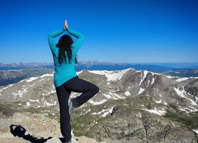
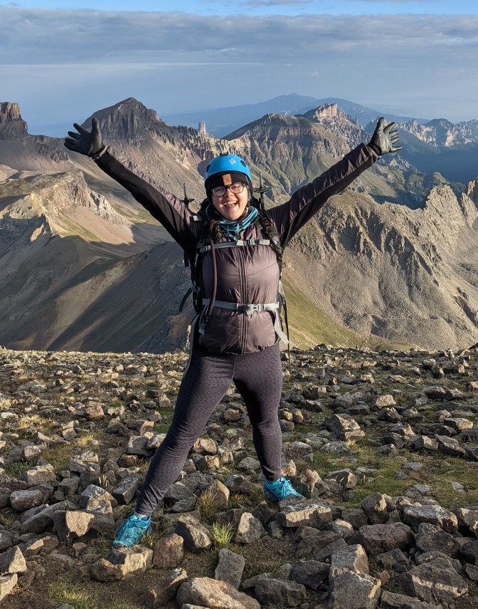
At 13 years old, I had the opportunity to summit my very first Colorado 14er with Cheley Colorado Camps. On the summit that morning, my camp counselor suggested we dedicate this climb to someone important to make this climb even more special. I decided to dedicate my climb to my baby sister who passed away when I was 10. Longs Peak became a very special and sacred place for me from then on out. I have summited it 3 times, climbed Mount Lady Washington for it’s epic Long’s Peak views, hiked to Chasm Lake more times than I can count, and just get unbelievably excited whenever I see mountain any time I drive into town. After that first summit was also the first time I really began thinking, and dreaming about the possibility of one day summiting Mount Everest.

Longs Peak was my first real connection with the mountains. The meaning placed on the summit that day gave me a truly spiritual connection to that peak. Before that I honestly hated hiking. As a kid, it was always a miserable experience. It wasn’t until I was able to find my own genuine connection to the mountains and nature that I was able to truly feel that sense of calm and peace I continue to experience in the mountains today.

Longs Peak helped me heal. When I was 21 years old I was in recovery from my eating disorder, I had already made a goal in the back of my mind to work up to the ability to travel to Everest Base Camp, but I didn’t quite yet believe it was possible due to years of self-doubt. Summiting Longs again gave me the confidence to realize that it was not only possible, but really got the ball rolling on working towards making it actually happen.

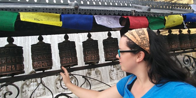
When I eventually got to go to Nepal and see Everest for myself in 2017, that became the most profound and defining experience of my life. My spiritual connection with the mountains grew stronger than ever before. I was already at a point of transitioning away from the religion I was born and raised in, and Nepal really helped me in my journey. I found more peace and serenity in those mountains than I had ever felt in any church building. I met the most genuine, kind, and loving people in Nepal, more than any Christian I have ever met. I was not focued on the persuit of a summit, rather the journey and the experience.

I believe in the magic and power of Mother Earth. This planet is magnificent. When you are able to truly connect with nature, your eyes are open to all the cycles of life this planet has to offer. When I am able to connect, I feel completely in sync. I feel calm, and completely present in the moment. The anxieties, stressors and worries of life completely melt away. I feel… at home. That is the only way I can think to describe it. I feel like I belong. That feeling is indescribable no matter how hard I try. I feel like I can fly when I’m skiing. I feel like I’m on a cloud when I stand on top of a high peak. I feel serenity sitting next to a calm lake on a sunny day. I feel awe and wonder when I watch the magic of a sunset or sunrise.

Much of the time, I have been able to get that warm bubbly feeling anytime I’m out in nature. However, in the last couple years, persuits of some big climbs have left me in a rut where I have had a harder time connecting. Anytime I had to do a “training hike” with a heavy pack, or go just for the sake of getting miles on my feet and altitude for my body, or anytime I felt like I was just checking off a list I have been lacking that connection. It was burning me out and I wouldn’t want to climb.

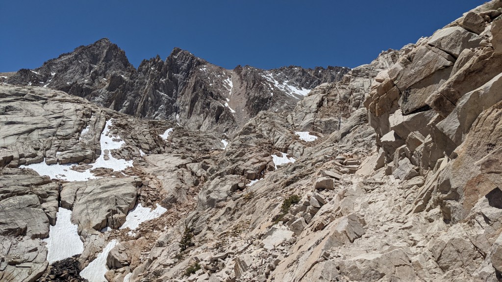
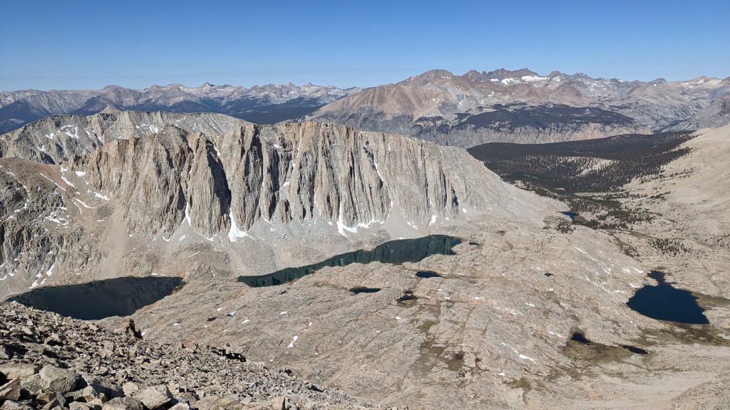
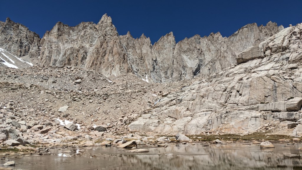
Last summer, I developed a stress fracture after climbing Mount Whitney. I was forced to take 2 months off and it really gave me time to think and re-prioritize a bit. My first 14er after my foot healed was Wetterhorn and it was the most fun I have ever had on a 14er ever! I wasn’t climbing it to check it off a list, I wasn’t climbing to “train”. I was climbing it just for fun, with my friends and to enjoy the beauty of the mountains and it was a reminder of why I climb in the first place. I told myself from then on, I was going to really try to make sure I was always climbing for the right reasons. It was then that I also decided I was no longer going to focus on the Seven Summits. Everest was always the main goal, anything else was a bonus.

When my best friend passed away at the end of December, it broke me. That desire for my natural connection became even more important. Rowan and I met at Cheley and climbed mountains in Rocky Mountain National Park together every summer as we were growing up. She was just as connected to nature, if not more so. I feel closest to her in those mountains, and in nature in general. I spent much of the first half of the year battling my mind. I would try to make sure anytime I would go out into nature to make sure I was going for the right reasons, but I was also still once again trying to train for Rainier. Motivation to train was completely non-existent as I battled a cycle of grief and depression. Getting out in general was incredibly difficult so I would try to really listen to my body and mind.

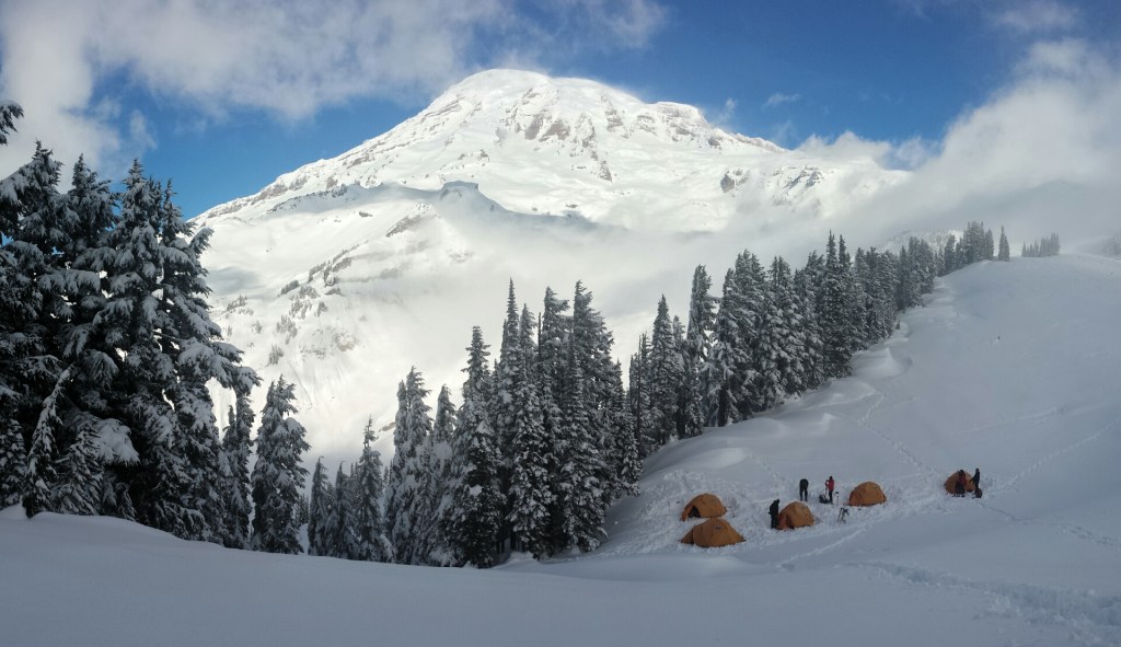
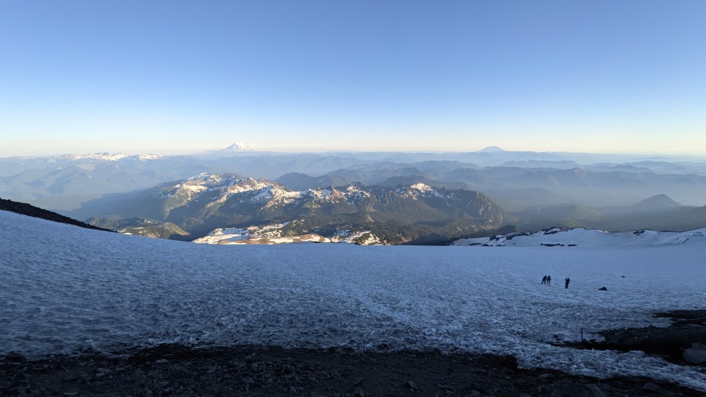
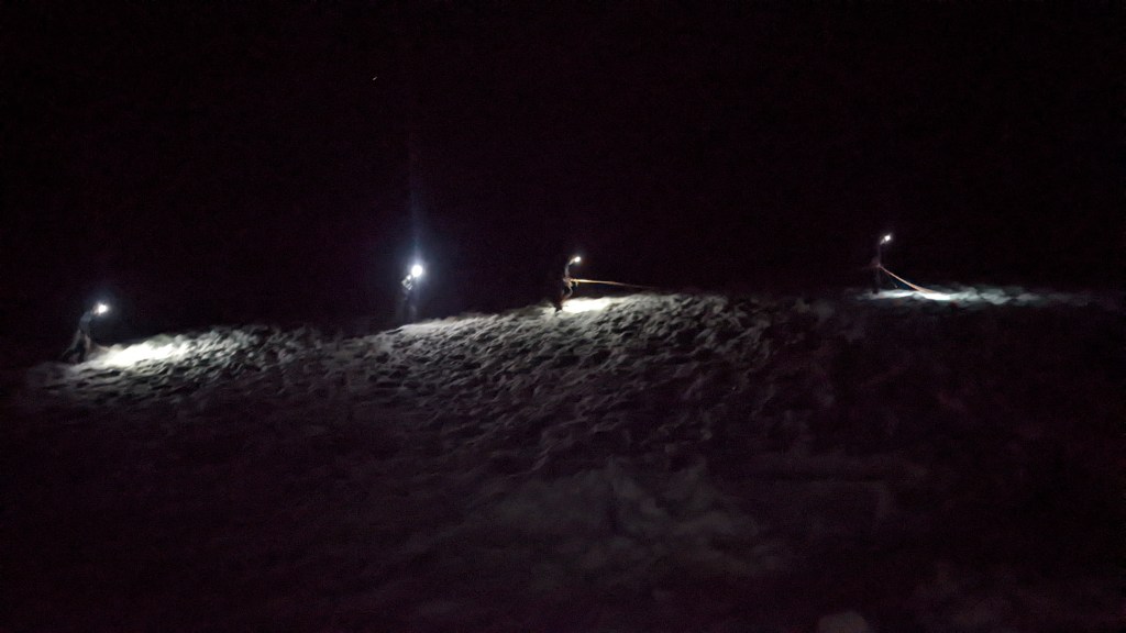
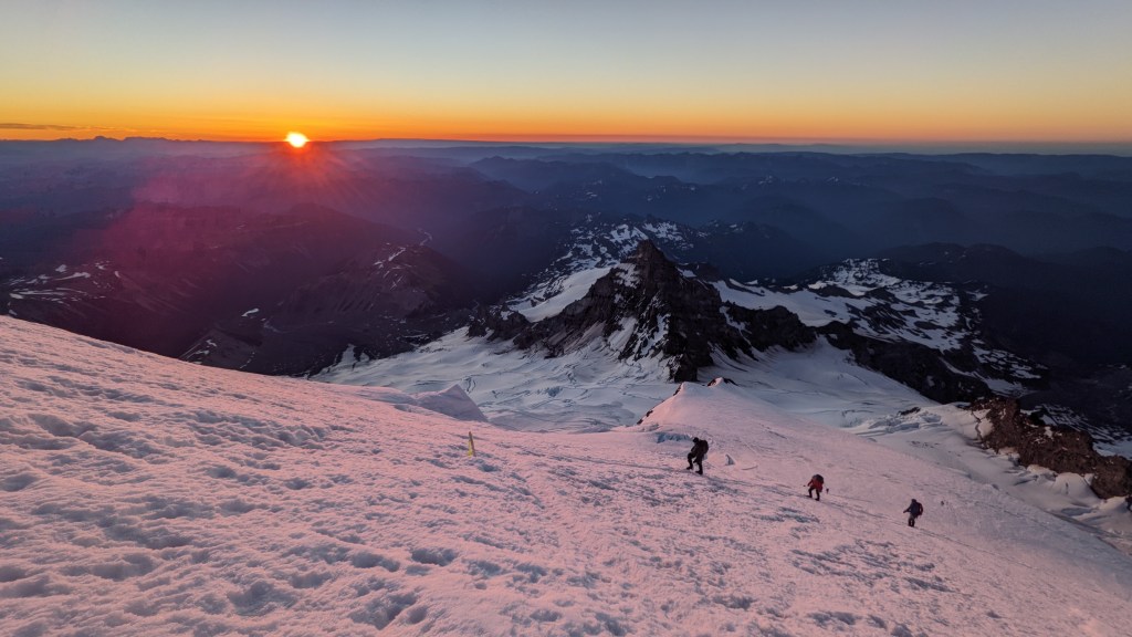
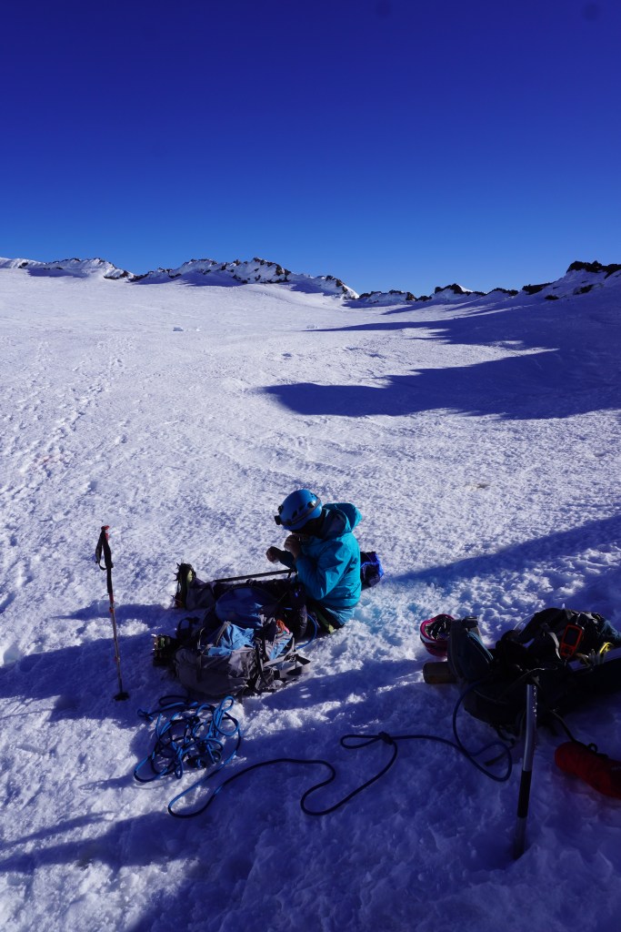
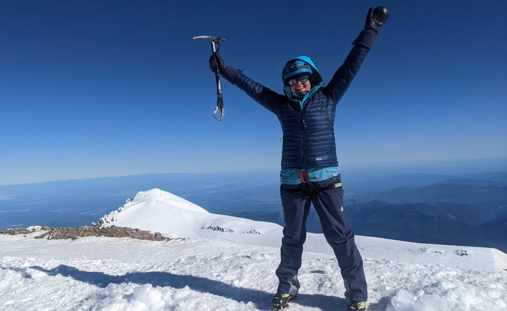
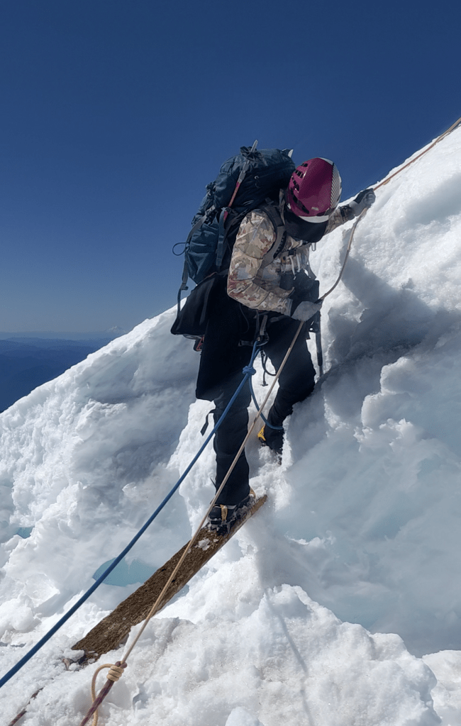
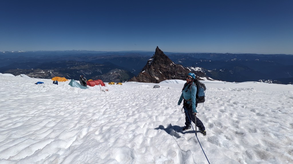
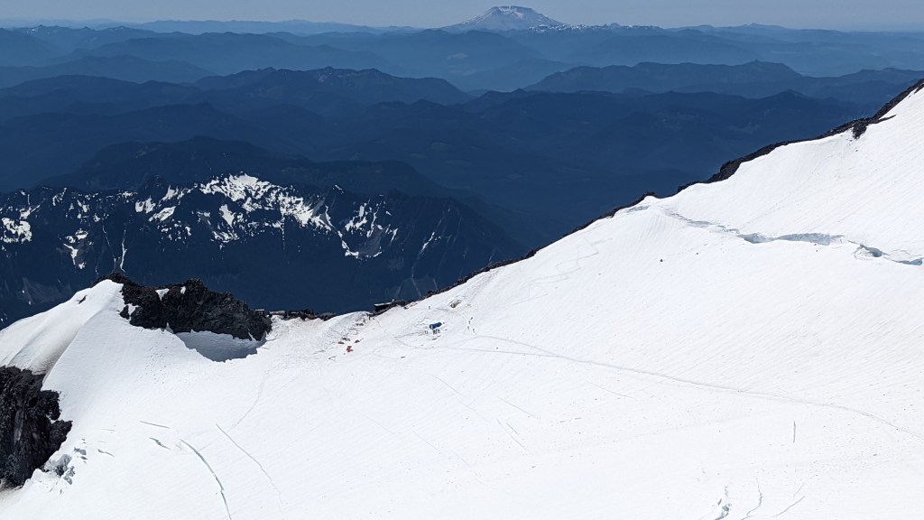
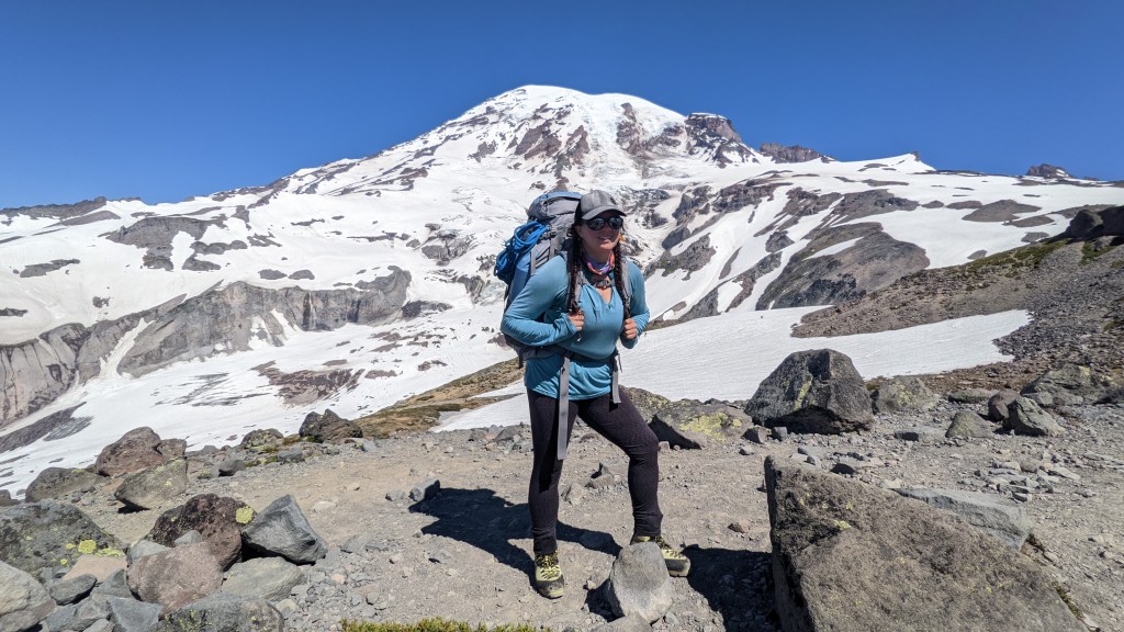
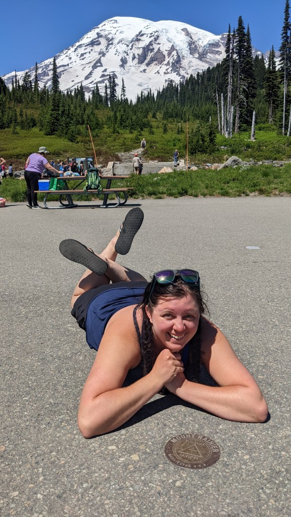
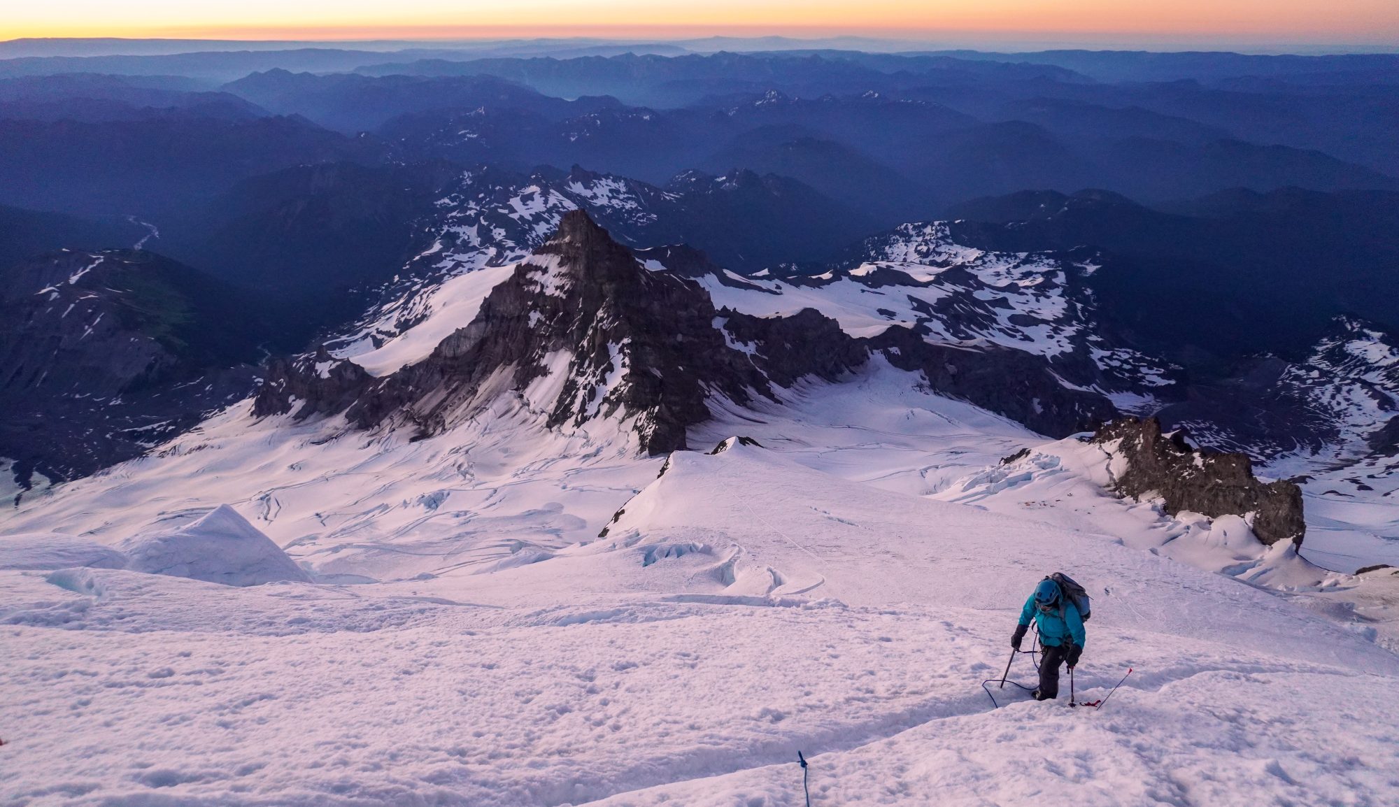
Rainier finally came along, and I finally got to check that mountain off my list. It had been a long time coming and it was such a weight off my shoulders to not have to train every year and not have it happen. I had fun on Rainier, I had moments of connection, but I also struggled mentally. It was beautiful, and magnificent, but it was also the hardest climb I have ever done so far… Harder than Everest Base Camp and Kala Patthar, and harder than Kilimanjaro. Because of how difficult this year has been on me mentally, I was much more suceptible to those intrusive thoughts of negative self-talk and fears. But looking back with hindsight I know it really wasn’t that bad, but at the time it was incredibly difficult. Overall, it really fueled the fire inside me and I felt more ready than ever to tackle the next big step towards Everest.

Shortly after Rainier, it was a rollercoaster of figuring out my next move. I had a new teaching position that was definitely going to be difficult in working around for getting time off to go climbing. I was debating on Aconcagua over my Winter break but flights were out of control expensive and there was no guaruntee I would get the time off approved around my Winter break. After talking with some climbing friends that went to Everest this last season, I decided maybe Denali would be a better option as climbing season is in June during summer break, and much more teacher friendly. It is a mountain I am much more interested in for one, it is incredibly physically and mentally demanding and would be an excellent test for Everest. However, it technically does not meet the 6500m requirement for Everest permits. I was not really worried about the altitude as I have never had a problem, and naturally acclimatize pretty well. I had hope that maybe it would still allow me to climb Everest without having to meet the 6500m requirement but I would be taking a huge gamble.

Just when I was about to do my Denali paperwork I finally got covid after 2 1/2 years of avoiding the plague, and it did a number on my asthmatic lungs and immune system. My asthma became much more sensitive and my allergies got much worse. I was dealing with a lot of wierd long-hauler symtoms which eventually lead to a near fatal asthma attack. The attack was then followed by an anaphalactic reaction to the prednisone I was perscribed to help with my asthma inflammation. That allergic reaction was then followed by another severe asthma attack. I felt my worse fears coming to fruition… “what if my body fails me and keeps me from going after my dreams?” I put Denali on hold while I dealt with my health, but it also gave me time to rethink my climbing priorities a bit. Everest is my #1 priority at this point when it comes to my bigger climbing goals. As much as I would love to eventually do Denali as well, I really want to try to get to Everest as soon as possible, as efficiently as possible and I shouldn’t risk gambling whether or not my expedition leader will let me climb Everest with Denali as my highest point. I need to climb something high enough and technical enough to meet the requirements for Everest, and to help me feel confident and ready.

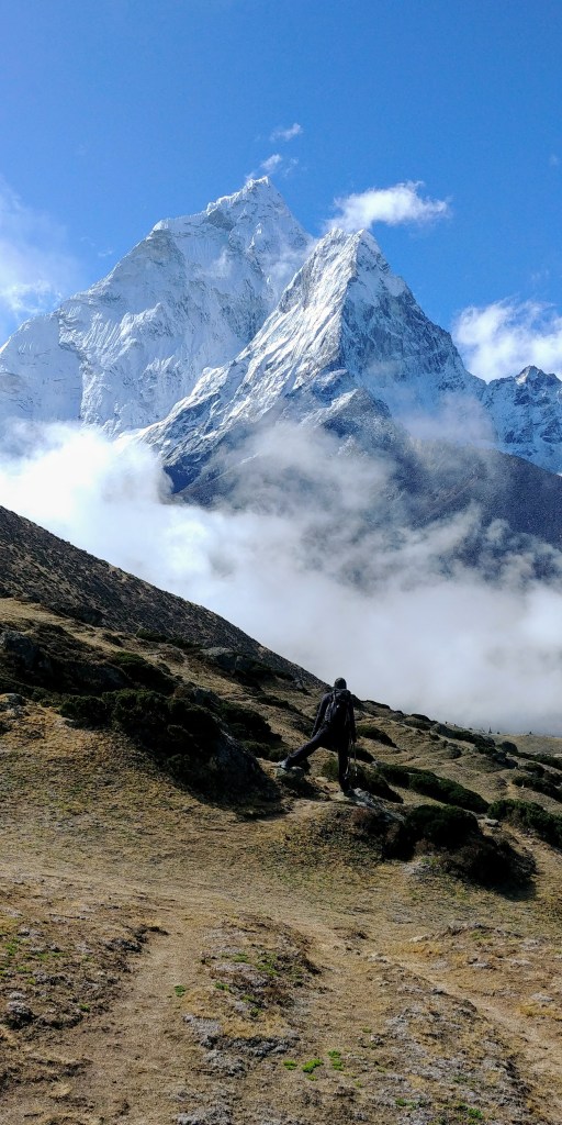
The more I thought about it, the more I also realized I want to again ensure I am climbing everything for the right reasons and focusing on that connection with the mountains, and not just checking something off my list. I thought back to my first trip to Nepal, and how I felt there. I wanted to feel that again. In reality, I have wanted to go back to Nepal ever since I first returned. Ama Dablam is a mountain that gave me incredible awe while I was there. I have never seen anything more beautiful in my life. I told myself, in those fields above Dingboche as I stared up at those magnificent walls, that I would climb that mountain some day… and that is exactly what I am going to do.

After Everest Base Camp, I got lost in the checklists, I got caught up in the Seven Summits, and got burned out on the endless training. I would occasionally feel ambivalent on certain summits, bored on others. I lost the spark. I want EVERY mountain to feel special and meaningful to me. I want to do it right. I don’t want to get to Everest and feel that ambivalence… I want to embrace the awe and wonder of standing on top of the world that first intrigued me as a kid. I want to climb the mountains that inspire me, that give me wonder, and help me feel grounded and connected. No more lists.

I am aiming and hoping for Ama Dablam Fall 2023, however there are some hurdles to jump over first. Physically, I need to ensure my body can get back to where it needs to be. My asthma has been much better the last couple weeks and I have been slowly re-introducing cardio and weights. I still fatigue quickly and lack endurance, but I have had some successfull ski tours and am feeling confident that I can be ready to hit up some Colorado 14ers for altitude come summer. I also need to figure out my next move with work. Climbing season for Ama Dablam will be October-November, and teaching and climbing in Nepal aren’t exactly cohesive… I’m figuring it out, but when I want something, I will make it happen. Ama Dablam WILL happen. I have never felt more calm and condifent about a climb in my life.

I’m ready.

Climbing for Campers:

In honor of my best friend, Rowan Meredith, I am planning on climbing Everest in her memory. In congruence with my climb, I am raising money to send kids to camp through the John Austin Cheley Foundation. This scholarship program helps kids who couldn’t otherwise afford it have the opportunity we had to grow confidence in themselves, build lasting friendships, and create memories to last a lifetime. Camp meant the world to Rowan and I, and I want to share that opportunity with others. 100% of the proceeds raised will go to the foundation. If you are willing to support this cause, you can donate here.

TRIP REPORT: Mount Rainier (14,411′)

I have been waiting a VERY long time to write about this one. I can’t believe it’s finally done! This mountain has always been about timing, and that rang true even for this climb.

In January of 2016, I ventured to Mount Rainier for the first time to attend a glacier mountaineering course hosted by Dan Mazur of SummitClimb. We were not able to go for the summit due to weather conditions but it was a great learning experience. From that point on I was hooked and knew I needed to come back asap.

Rainier views back in January 2016

I planned to return that summer with a friend, unfortunately they weren’t able to commit. So we postponed to the following summer, and again the next year and the next. Eventually I decided I needed to find other partners who were interested. I gathered a group of friends who were ready to go and committed, and then COVID hit. We waited and watched for the government to lift restrictions. In June 2020, Washington began to move to their “2nd phase” of opening from the pandemic, and the rangers announced the upper mountain of Rainier was open and we were stoked and ready to go.

However, within that first week of opening, 2 climbers died. About a week later, right before we were about to get our plane tickets, the park service announced the DC route was not established. Guide services were not yet taking clients up the mountain due to covid restrictions and we would have to do our own crevasse navigating… something I wasn’t super comfortable with while taking glacier newbies up the mountain.

We ultimately postponed. In 2021, I contacted each of my friends from the 2020 group and everyone had circumstances keeping them from climbing that summer. I found another partner and we planned for Labor Day weekend. Unfortunately, I fractured my foot in June and then Washington had massive heatwaves shutting down the upper mountain completely by the end of July… It just wasn’t our year.

This year I knew I need to make it happen. I have bigger fish on my list and I wanted to get Rainier over with and out of my brain. I established a group early, plenty of time to plan and prepare and then my best friend suddenly passed away and I was really struggling. I still planned on Rainier and we applied for a permit for the 1st of July. However, I was not really training much as I struggled with depression and grief. As we got closer, conditions were complete opposite of last year. The wettest spring in like 75 years. “Juneuary” literally hashtagged. Full blown winter conditions in the summer season. Guide groups weren’t summiting as avalanche danger was insanely high and the snow just kept on coming. On top of all that, our group slowly fell apart and it was debate of what to do.

Eventually things calmed down. We had already decided not to go for July 1st due to conditions but I knew if I had the chance I still wanted to make it up there. I didn’t have much time as I have to go back to work first week of August, so I watched, I waited, I asked around for anyone willing to just sporadically go for it should a weather window open. That’s when I met Mandie, she tried to summit in the heatwave last year and had to turn around due to rapidly deteriorating conditions as things melted out like crazy. We met up and took a hike together, talked shop and came up with a plan. We had a tentative window of time and decided to watch for the weather and pick the best day and hope for luck with walk-up permits.

It was game time! We had our dates, and luckily last minute cancellations opened up spots online for Camp Muir. We booked them and on Sunday July 17th, we took a LONG drive to Paradise.

We camped in the parking lot and woke up Monday morning to a foggy, misty scene. Webcams showed sunny skies at Muir while the lower mountain was socked in with clouds. We packed up, checked in, and officially headed up the mountain.

Our plan was simple, take our time. Go as slow as we need to, and do whatever we needed for the best chance of success. Our initial plan was 2 days (with a third day on reserve), hike to Muir, take a power nap and then head for the summit come midnight or so. We were both feeling great at first. I was even giddy and surprisingly confident (usually anxiety wins). I was never more excited to climb a mountain. We felt strong, and steady until pebble creek, then we headed up the Muir Snowfield, a 3000′ slog to say the least. That snowfield kicked our ass, and definitely slowed us down. It felt never ending and was painfully slow with our 50+lb packs.

We made it to Muir at 6pm, much later than anticipated. There wasn’t much time to get settled to we set up camp as fast as we could and started melting snow for water. We finally settled in, and ate what we could. Mandie was feeling headachey, tired, and nervous about immediately getting back on foot. We decided to try to sleep and see how we felt come 11pm when we planned to get up. 11 came, we didn’t get any sleep, and the ultimate question loomed, do we go for it or wait a day? Monday night to Tuesday morning was predicted to be calm, perfect weather. Tuesday night to Wednesday morning was a bit more of a gamble with winds. For me personally, an extra day also meant I was more likely to get anxious. I felt good, a little tired but overall I felt very much like I could push for the summit that night. Mandie was less sure. She didn’t want a repeat of last year (where she did push in 2 days and struggled) and she was suffering from mild altitude sickness. For the best chance of success we decided the smart thing to do then is wait. Rest up, acclimatize, and go for it the next night.

It truly is all about the right timing.

We had a lazy day in camp, slept in, are, drank water, lounged around, I did feel a little antsy but overall I was feeling better about having to wait an extra day. It was the smart decision and it gave time for our legs to rest. We went to bed early, attempting to get a couple hours of sleep and then the alarms went off.

11pm getting up and ready to go. A headlamp snaffu caused a bit of a delay but we still started off just after midnight.

Slow and steady in the conga line with guide groups that left at the same time we worked our way to Ingraham flats. A couple mild cravssses to hop over but nothing crazy. Feeling good so far, just taking it all in stride. Up through the bowling alley and that’s when the real adventure began: the Disappointment Cleaver.

Fixed ropes were set up to help traverse the rocks, and not that we could totally see but there was a good amount of exposure below. Those fixed lines worked their way into an insanely steep ascent up the snow covered spine. As we worked our way up the Cleaver we heard a pretty massive avalanche slide down the glacier below (which was rather unsettling). Off the lines, steep switchbacks through snow and rock continued our ascent. Panic attack ensued. The snow conditions were slippery and sugary, making the steep exposed conditions even freakier. Slowly but surely we worked our way to the top of the cleaver. I knew with the heat of the day, this would be the worst part coming down (spoiler alert: it was).

Views opened up as dawn approached and we could see the ascent ahead of us. My initial impression was we could see all the way to the summit from there. I was very wrong. It was a much more mild incline up from the top of the cleaver and less terrifying. We worked our way up and eventually things got steeper. More crevasses made themselves known. The sunrise was absolutely gorgeous and I was feeling better.

As we worked our way up, every time I thought I was getting close to the crater crest, more of the mountain would appear and crush my spirits. This happened at least 4 or 5 times. The false summits were starting to really get to me. We hopped over a few more crevasses, and crossed a small crevasse bridge. When we approached the last crevasse crossing, a guy coming down explained how close to the crest we were. With his description I was thinking it would be fairly quick. Assuming it was the ridge above me, I had high hopes we were nearing the end.

But as we worked our way up, yet another false summit appeared, the real end to it all seemed like another like 5000′ away. I was out of gas after going nonstop for 4 straight hours without a break (because I kept thinking I’ll just break at the crater crest thinking it was closer than it was.) Slowly but surely we made it to the crater and I collapsed and cried. Relieved we made it but also knowing I needed to finish the last 400′ to the true summit. We dropped our packs, ate and drank a bit and then worked our way across the crater.

Windy but a sigh of relief. I did it. FINALLY.

It may have been a slow night but we summited at 8:30am.

After snapping some photos we headed back to our packs, ate another quick snack and loaded up for the descent.

This is when things got even more interesting. Things heated up in the sun FAST. The crevasse bridge melted out twice that day, by the time we crossed it, it was a slushy mess and coming down it was definitely sketchier than on the way up. The further down we went, the slipperier things got. Steep switchbacks we’re a challenge to keep from slipping, and then we approached the top of the cleaver.

Nervous knowing what was ahead of us, we carefully worked our way down the cleaver. Everything was slippery slush, rocks were falling, we kept post holing and slipping, it was a giant mess. We spent maybe half of that cleaver descent on our butts, carefully scooting down steep pitches, meanwhile a sharp dropoff was right next to us. We finally made it to the fixed lines where we could at least clip in with backup protection, adding a little later of comfort in the sketchy conditions. It also symbolized nearing the end of the most dangerous part of the route. We worked our way down the lines and finally we were off the Cleaver. A quick walk past the bowling alley and we were officially out of the most danger.

We stopped at Ingraham flats to take a breather, get some water and process what we just survived. After 3 hours of descending sleep slippery snow, we only only about 45 minutes left to camp Muir. Homestretch. 

The remainder of the route was fairly easy and straightforward, but complete mashed potatoes. Step, slip, step, posthole, step was the name of the game. Camp was in sight, it was finally over.

Well mostly. 

My partners knees were totally shot, and my feet were killing me from pounding on them for 13 1/2 hours. She did not think she could get back to Paradise today, and as much as I want to sleep in a bed and shower, I also really didn’t think my body would appreciate another 4500′ descent with a heavy pack.

We decided to wait until the next morning to head down and give our bodies some much needed rest. We packed up camp and took a glissade trip down the Muir Snowfield. It only took us an hour to get down the 3000′ of snow to pebble creek. From there it always a self explanatory follow down the trail back to Paradise. Getting to the parking lot was bittersweet. My feet were killing me, my legs, back and butt all sore. But we did it. We finally did it. Rainier was finally complete!

On the way out, we stopped in Ashford for some much needed real food. We decided to take a bit of a scenic route on the way home so we could pit stop at a waterfall we both had really wanted to see. Multomah Falls was absolutely stunning and it was a great way to end our adventure.

Overall, I am very relieved and proud to have finally checked this mountain off my list. It has been a LONG time coming. It may not be the tallest mountain I’ve climbed, but it most definitely was the most physically and mentally demanding climb I’ve ever done. It is definitely an accomplishment worth celebrating.

TRIP REPORT: Wetterhorn Peak (14,015′)

What a cool peak! Wetterhorn was a blast. This might be my #2 favorite fourteener now because it was so much fun! My favorite part was definitely the infamous final pitch and would do it again in a heartbeat.

This was an all nighter adventure for most of us and we were all feeling it by the end. That Friday evening, I drove from Salt Lake, my climbing partners drove from Denver, and we met up in Lake City and headed immediately to the trailhead aiming to summit by sunrise. We parked at the 2WD trailhead before all loading in my friend’s 4Runner to climb the super sketch 4WD road to the upper trailhead. (High clearance vehicle DEFINITELY needed) We started hiking by about 3am and while we were taking our time, we were still making great time as the first 2 miles breezed by in less than an hour. The trail was very well marked and easy to follow in the dark.

Navigating the boulder field on the way up to the saddle was a bit trickier to follow in the dark, but easy in the daylight. The trail is still fairly visible and easy to see in light as we came down, but we did get off track a tiny bit on the ascent in the dark as it was harder to see. Once on the ridge, the trail heads up a steep sandy section before entering the class 3 section. Navigating the class 3 section felt a little like a choose your own adventure. There were a small handful of cairns sparsley laid out, but getting up to the flat spot really was up to you as long as you stayed infront of the rock rib. Some of us tried to climb the rock rib thinking we were already at the notch… Not Reccomended. Ended up in some class 4 territory for a second and had to backtrack.

On the class 3 ridge with the Notch and summit above us.

After navigating the ridge for some time and watching the sun begin to rise behind Uncompahgre, we made it to the flat spot just before the notch. This signifies you are like 10 minutes from the summit and you can see it right infront of you. After climbing the notch, and butt-scooting down the slab, you come to the base of the final pitch which has super solid holds and feels like your climbing a natural ladder. This was definitely the coolest part of the route. Comparitively, I would say this was steeper than the homestretch on Longs Peak, but easier and shorter as the homestretch gets SUPER slippery and feels way more exposed. As steep as this pitch on Wetterhorn is, it feels a bit enclosed as you climb and you don’t feel as exposed as it looks.

We came up on the summit at 7am, just in time to see the sun finally come up over Uncompahgre. The morning views were spectactular and we even found out later, a nearby climber on Matterhorn snapped a photo of us on the summit!

Heading down that final pitch wasn’t as nerve wracking as one would think. It is so fast and you’re done before you know it. Navigating the remainder of the class 3 section was much easier to follow on the downhill as we could see the route below us. After that, the trail was once again easy to follow back to the car.

Us on the summit of Wetterhorn! Photo by Todd Field

Overall, I freaking loved this peak. It was such a fun climb! Highly reccomend for those new to class 3 peaks, I thought this was a fairly mild class 3 and would be a great first one for those working on their fourteener climbs and working into more technical climbs. 4WD and high clearance definitely needed to get to the upper trailhead (we were nearly sideways at one point). If you must start at the lower trailhead, it will add a little bit of extra mileage.

Happy Climbing!

TRIP REPORT: Mount Whitney (14,508′)

Climbing the highest peak in California and in the contiguous US was quite the adventure! Not only did we climb Mount Whitney, but we traveled through Death Valley National Park and Badwater Basin (the lowest point in the US) to get there which made for a pretty cool way to mark this off the list. Almost 14,800′ of gain in less than 24 hours. This trip is one I most definitely reccomend, but there are some things you should know before you climb.

PERMITS:

Whether you aim to climb Mount Whitney in a single day, or backpack in and camp, Whitney is a permitted climb no matter which route you take. They have a lottery system in place for permits at Recreation.gov that opens Febuary 1. According to the Inyo National Forest site, only 34% of applicants were awarded their requested dates in 2019. Each year more and more people apply, lowering the chances of success. Once permits have been awarded March 24, remaining applicants do get first dibs at whatever dates are leftover on April 1. Web sales open May 1 and people have been lucky to occasionally find something that is left, but they typically go incredibly fast.

BEST TIME TO CLIMB:

Mount Whitney is located in southern California. Depending on whether it is a La Nina vs El Nino winter can actually help determine how much potential snow Whitney can hold in a given year. I summited June 10th which typically would warrant early season conditions with plenty of snow, but with a record dry year, and high heat, our route was virtually snow free. Heavy El Nino years can mean there is snow at Trail Camp and up the cirque of the 99 switchbacks well into August. When you apply in Febuary, take a look at snow water reports for California, as well as future forecasts for the remainder of spring to give you a guestimate of what the summer may look like as you plan your climb. Typically the later in the summer you go, the better your chances are at a snow free route. However, the later into summer you go you also risk monsoon season and will be racing weather on your climb. Always check weather and conditions before you go. Bring microspikes (and possibly an ice axe) if there is still snow, and always watch the clouds as you do not want to be on the high mountain in a thunderstorm.

THE ADVENTURE BEGINS!

Coming from Utah we had a few different options for driving to Whitney Portal. The fastest reccommended route went through central Nevada where there is essentially nothing. However for just about an extra hour of detour, by taking I-15 south to Vegas, we could drive through Death Valley on our way and hit up Badwater Basin, which is what we decided to do!

Initially, I personally had ZERO desire to ever visit Death Valley. It’s notoriously hot, and I don’t do well with heat. But with it literally being on the way, and having the opportunity to hit the lowest point and then the highest point, we couldn’t pass it up. We lucked a little bit with the weather as it was incredibly windy and cooler than usual (by cooler meaning it was 102 degrees instead of 122). I was also pleasantly surprised at what all the park had to offer. I was very much expecting just a desolate valley wasteland and I had no idea there were petrified sand dunes, and incredibly textured prominent peaks that looked like they were out of Star Wars until we got there. We whitnessed a couple dust devils, and of course took a pit stop to the low salt flats of Badwater Basin, the lowest point in the US at -282 feet below sea level.

A quick note if you decide to go through this park ever (especially in the summer): have lots of water in the car, make sure your tank is full, your antifreeze is full, and your tires are good! It is the largest national park in the country and there is little to no cell service in the park and would be a terrible place to break down.

WHITNEY BOUND

After our adventure in the desert, we made the remaining 2 1/2 hour drive to Whitney Portal, located just outside the town of Lone Pine. Car camping at the trailhead is not allowed. There are about 25 walk-in campsites located at the portal. A little further down the road is Lone Pine campground. Those spaces are reservable and is a cool place to camp with all the rocks. Whitney Portal is in active black bear territory. You cannot leave food or anything smelly in your car, bears have and will break into cars. There are bear boxes in the parking lot to store your food while you hike which is really conveinient. There is a little gift shop and grill at the portal it seems like their hours vary just a little from season to season. Currently they are open until 6:30pm so if you return from your hike before then, definitely reward yourself with a burger! It will taste so good after a long day on the mountain.

We started our climb at midnight. When we initially arrived at the portal the afternoon prior, it was insanely windy. Gusts at the summit were topping 80-90mph. People coming down that evening looked absolutely hammered and defeated. The winds were forecasted to die down overnight and by sunrise be reduced to sustained winds of maybe 10-15mph rather than 45-50. We prepared for wind and cold, however we severely underestimated just how cold and how windy…

There are several landmarks that can help break up this long hike, especially if you opt to do the climb in a single day like we did. Something important to note as well is that AllTrails is off by a couple miles. We used Strava to track and found it was a grand total of 23.4 miles round trip. Checking several other reports as well as just monitoring our pace with experience, I think our Strava track was more accurate. The first landmark was the log bridges and Lone Pine Lake about 3 miles in. We were moving at a solid pace and arrive at the sign for the lake about an hour and a half into our hike. About a half hour and a mile later we arrived at Outpost camp area, and within another half hour and just shy of another mile we made it to Mirror Lake putting us just shy of 5 miles in a little less than 2 1/2 hours.

“The Traverse” in the daylight. Note how rocky this is.

The next 2 miles were more brutal than I expexted. I thought we only had a mile left to Trail camp since I was going off inaccurate information, but in reality, we had 2 miles, and they were long and awkward. I dub this section the “Whitney Stairmaster 5000”. The trail steepens and becomes incredibly rocky. There are a couple landmarks such as coming up through treeline, “the meadow”, and “the traverse”, but it was so dark we couldn’t see anything anyway, and we were battling brutal winds. The higher we got, the windier and colder it got. This section also slowed us down. It took over an hour and a half to get through this section. Most of the trail was straight forward, but there were a few spots that tripped us up in the dark and we would have to stop and figure out where to go.

Finally, we make it to Trail camp at 12,000′ and nearly 7 miles in. It’s 4am and the winds were so cold, Trail Camp Tarn literally re-froze overnight. Our camelbacks were frozen and our waterbottles were becoming slushies. We took a pause under a rock trying to escape the unbearable frigid winds and debating our next move. We decided to keep going hoping that the 99 switchbacks would be somewhat sheltered from the wind because of the apparent direction it was coming from, and that the sunrise would bring some warmth and calm the winds as forecasted. We slowly made our way up the switchbacks, finding that once we were up several of them, they were slightly sheltered and gave us a bit of relief. We were at about 13,000′ come sunrise at about 5:30 and it was absolutely stunning. It really gave us a second wind to help us push on.

We made it to Trail Crest at 13,650′ and it was immedately back into the cold frigid winds as we transitioned to the shady back side of the mountain. Despite being freezing, the views of the west side with Guitar Lake were stunning. The trail drops down about 200′ (which was a bitch to climb back up later) to meet up with the junction of the John Muir Trail. We check the time at the junction to see it is 6:40am and we have just shy of 2 miles left to go. While most of the backside is fairly flat, its rocky, and uneven talus at high altitude making it slow, and for us, almost painful in those frigid winds. The final 500′ or so were probably the most brutal for us in the winds the entire climb. We were completely exposed to the full force of the wind, no more big rocks to hide under, and at this point it was just telling ourselves “we can warm up at the summit shelter and get out of the wind” that kept us moving.

We summited at 8:30am. When I checked the weather later I found out we still had 25mph sustained winds and gusts up to 40 on the summit at that time, making our windchill -4 degrees (literally a 106 degree difference from the day before). We didn’t stay long. We snapped some very quick summit photos, hiding on the leeward side of the shelter in between shots. We headed down at 9am and pretty much didn’t stop until we reached Trail Camp again at about 11am.

Mount Muir is the tall one center left, Mount Whitney is on the right.

Here at the tarn, we took our first real break after 11 straight hours in the wind, only really stopping to catch our breath (and take summit photos). We hung out at the tarn for about an hour; enjoyed the warmth of the sun, ate some lunch, stripped some layers, took some photos, and finally took in what we just battled through, celebrating our crazy successful summit.

From here it was just a long 3 hours back to the car, but at least we got to see what we missed on the way up. Stumbling over rocks on the stairmaster 5000, We finally got to take in the views of the rocky terrain, see Mirror Lake, check out the Waterfall at Outpost Camp (that I didn’t even know was there on the way up), and see Lone Pine lake. The longest section was definitely those last 3 miles. While it only took an hour…. it was a mentally LONG hour to push through. It just never ends and you want to be done. With about a mile left I found I hit a spot with cell service on the traill and briefly called my dad and my husband to let them know I was almost down and to story tell of the crazy windy adventure we had.

Not including our summit break and hour long break at Trail Camp, it took us 13 1/2 hours total, though we spent about 15 hours on the mountain. About 8 1/2 hours to summit, 5 hours down which is about what I predicted. I was guestimating it would take us 8 to summit but those winds man… They will mess with your head and make you question your life choices.

As much as I would love to say this is a one and done mountain for me, I know it probably isn’t. I just hope next time there is less wind! XD

TRIP REPORT: Mount Elbert (14,439′)

There is no better way to celebrate the summer solstice than from the highest point in Colorado! Mount Elbert is located in the Sawatch Range of the Rocky Mountains just outside the city of Leadville. Not only is it the state’s high point, but it is the second highest point in the contiguous US. A steep climb, but definitely one for the books!

Looking N-NW from the summit

Out climb started just after 3:30am from the standard North route. The trail started off pretty moderately with switchbacks for the first mile, very doable. The trail then flattens out and actually heads slightly downhill for about 5 minutes of walking or so before you reach the Contintental Divide trail fork. This flat continues for just another half mile or so before the steeper incline begins. This first steeper section goes for another mile or so until you hit treeline and makes you question your life choices.

At this point, coming out of the trees the we were in twilight and sunrise was approaching. we slowly continued to make our way out of the trees just in time to see the alpenglow hit the peak in front of us and watch the sunrise. Once out of the trees you can basically see the majority of the route headed up the ridge. It is a slow steep walk but take your time and you will get there!

steepest pitch up 1st false summit

The crux of the route starts at about 13,000′. This is the steepest section and is a slow spot. Knowing you have 1,400′ left of climbing the first 900′ are right in front of you in a very short distance. This is the first false summit.

2nd false summit

As you come around the north side and to the top of the false summit you can see the second false summit in front of you, a more moderate incline in comparison as you make your way up the hill.

3rd false summit…

As you come up on this second false summit the 3rd and last false peak gets your hopes up as it LOOKS like it could be the real deal…. it is not. HOWEVER, as you quickly make your way up this last hill you can see the REAL summit and it is a simple 2-4 minute ridge walk away!

Actual summit just ahead!

Welcome to the roof of Colorado at 14,439 feet!!!!! We took our time on the way up as we encountered wind and cold and had to keep adding layers. We summited at 8:50am.

The decent took half the time for the most part. Some steeper spots were a little slow for those needing to be gentle on the knees. (bring poles) As for difficulty, its just the steep gain and the altitude. The standard North route is a class 1. Very well maintained trail as it is heavily trafficked. We did pass plenty of people who turned around early in the morning as they were not feeling it that day. Also, being June it was VERY cold and windy for us. It had snowed the day before so the summit temps were at or just above freezing that morning and the windchill was recorded at 17 degrees Fahrenheit! (burrr) Overall, it was a BEAUTIFUL day to summit.

HAPPY SUMMER!