Report from 6/20/18
Here it is!
I planned to get this out sooner, but I got home to find out I had caught a head cold from the guy sitting next to me on one of my connections home and have also been struggling with the jet lag pretty bad. I have been pretty miserable the last few days. But without further ado, here is my trip report of my Everest Base Camp Trek!
First, I shall answer a question which may have arisen for those who frequent my blog and may have noticed a “typo” in the title. Yes, I was supposed to climb Island Peak as well. Originally, this trip had 2 parts: trek to EBC, and climb Island Peak (Imja Tse) at 6189m (20,305′). Long story short, Island Peak did not happen, but that will be explained.
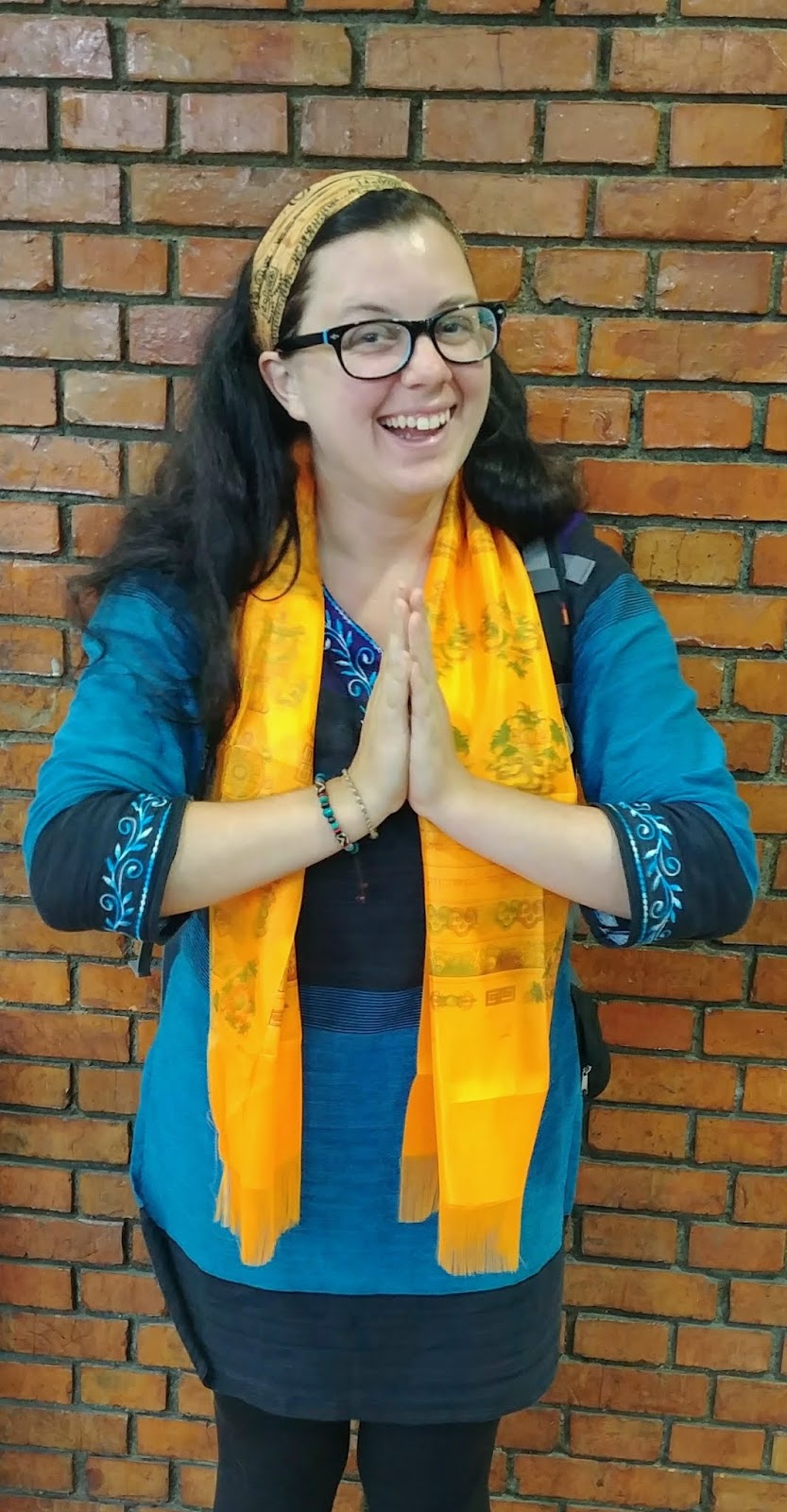
Most of what is written below is actually fragments from my travel journal. This is strictly just the trekking portion of our trip. I am not going to spend time on talking about my day in Singapore, or when I first arrived in Kathmandu because I have already discussed them but if you missed it, you can click the links to read about them! So to begin, we are going to start with our first day in the Himalayas:
DAY 1: LUKLA TO PHAKDING- 2,860m (9,380′) to 2,610m (8,560′)- 5/30/18
The morning started out in Kathmandu, misty and cool from rain the night before. Monsoon season is near, as we are at the tail end of may, and reports of many Everest climbers and crew had been stuck in Lukla for almost a week due to flights not being able to access the mountain. We head to the airport, hoping and praying skies are finally clear enough for us to get there. We are scheduled on the first flight out at 6am. We arrive, weigh our bags, and wait in the domestic terminal at Tribhuvan Airport for news, any news. Before we know it, we are on a little shuttle to take us to our small propeller plane, we board and we are off! On the plane, I had a giant smile on my face I could not erase, and tears coming to my eyes. Hazy skies make it difficult to see the tall mountains in the distance, but soon, we can see a hazy peak out the window of the plane, standing well above all others off in the distance. It’s Everest!

Landing in Lukla, at the world’s most dangerous airport, was not as terrifying as I anticipated. We had a very smooth landing, and was off the plane an instant later. Immediately we could already see Nupla, standing at 5,885m (19,303′), dominating the background. I nearly cried. I could not believe I was finally here! By a fun coincidence, my tent-mate from Rainier happened to be in Lukla at the same time! After catching up with her, we headed off. We have a small group. Gadul is our local guide and I am accompanied by one other, Juan from Bolivia, who is currently living in Thailand. The road to Phakding was downhill, and quick. We passed dozens of rocks, prayer wheels, stupas, and memorials covered in Sanskrit writings from the Monks of the monasteries. I learned that all of these sacred monuments must be passed on the left, or in a clockwise direction out of respect. These are the most peaceful mountains I have ever been to. Bells and chimes from prayer wheels ring, and chants in the distance can be heard from the Monks up the hill. The spirit of this land is something I have wanted to experience for years. I was in disbelief of the awe and wonder around me. Within a short 2 1/2 hours, we arrived in Phakding, got settled into our first teahouse lodge and enjoyed some downtime.
DAY 2: PHAKDING TO NAMCHE BAZZAR- 2,610m (8,560′) to 3,440m (11,283′)- 5/31/18

Day 2 was long, steep, and hot. The trail was very up and down, and there were stairs, so many stairs!!! I started the morning off feeling pretty good! As we started walking I could hear birds that sounded just like the Mockingjay from the Hunger Games. We passed plenty of porters bringing down stuff from base camp now that the season is over and I began to realize something; many of these young boys looks just like my high schoolers! When people think “Sherpa” there is a stereotype that comes to mind. A short man, wearing flip flops, smoking cigarettes, while hiking with up to 100 kilos on his back with a head strap used for balance. While this is seen sometimes, the reality is most porters are young teenagers. Some are wearing skinny jeans, Adidas, a flat rimmed baseball cap, and playing music on their phone while they walk. I asked Gadul how young some of the porters typically start and he said some can be as young as 14, working weekends while they’re not in school.
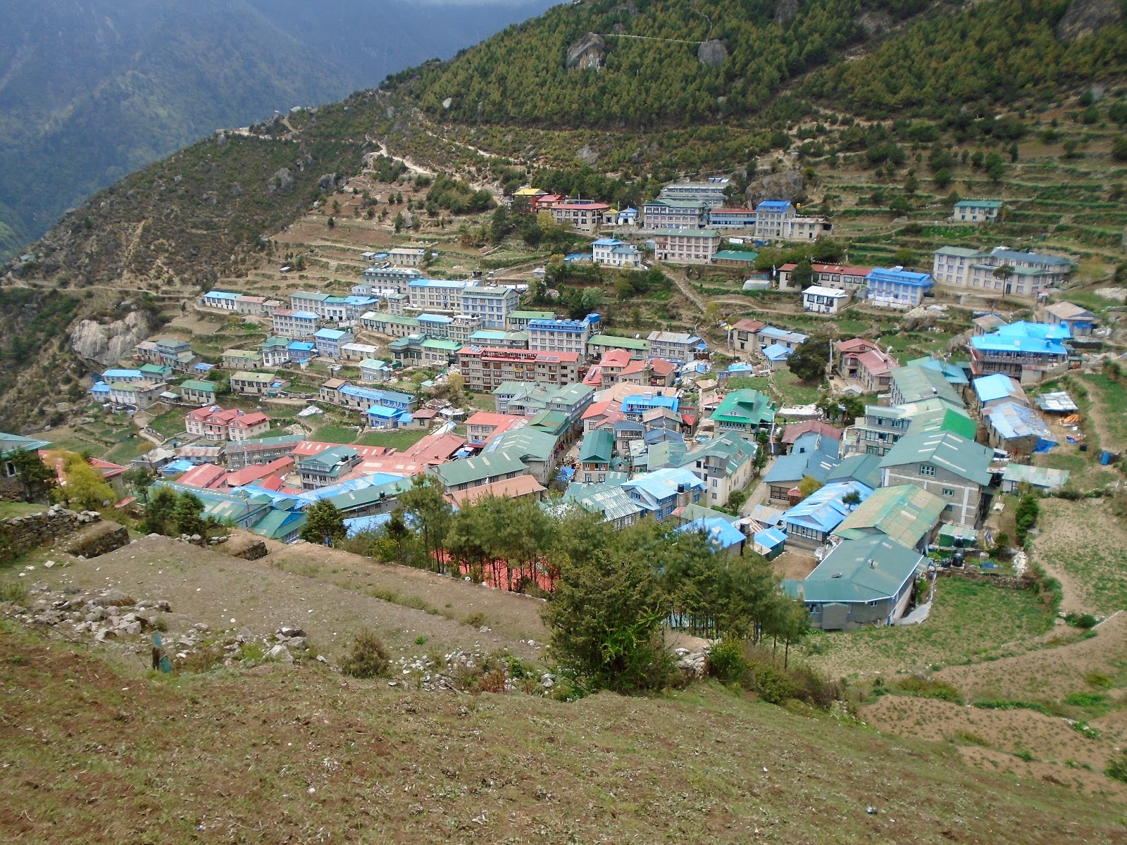
We stopped for lunch about 2 hours into our hike in a village called Monjo, where the official entrance to the National Park is located. We crossed 6 bridges on the way to Namche. The last bridge is known as the high bridge. you hike up a steep hill to get there, as it’s suspended around 100 meters in the air. The last 2 hours of the climb is up a steep cliff side. It was extremely slow going, especially in the hot sun. It did not help that whatever I ate for lunch was beginning to not sit well. By the time we got to Namche I was pretty wiped out and my stomach was killing me. I had a difficult time eating dinner because I was so nauseous, and then it hit me in the middle of the night… my first bout of traveler’s diarrhea. I knew it was not altitude sickness because of the simple fact that I had been training above 10,000′ for months. Plus, I had altitude sickness once before, this was different. I could nearly pinpoint that the goat cheese on my potatoes at lunch was the most likely culprit.
DAY 3: REST DAY IN NAMCHE- 6/1/18
After a “fun” morning in the bathroom, I joined everyone for breakfast where I tried to force down some oatmeal. The initial plan was to hike up to Khumjung, a town at 3780m (12,398′), but we woke up to heavy rain and clouds in the area. (I was pretty thankful for that) A few hours later, Juan knocked on my door to announce they were going to head up for a short walk now that the weather was clearing. After spending the morning lying in the fetal position, and taking some antacid medicine, I decided to join them to at least get out and stem some boredom.
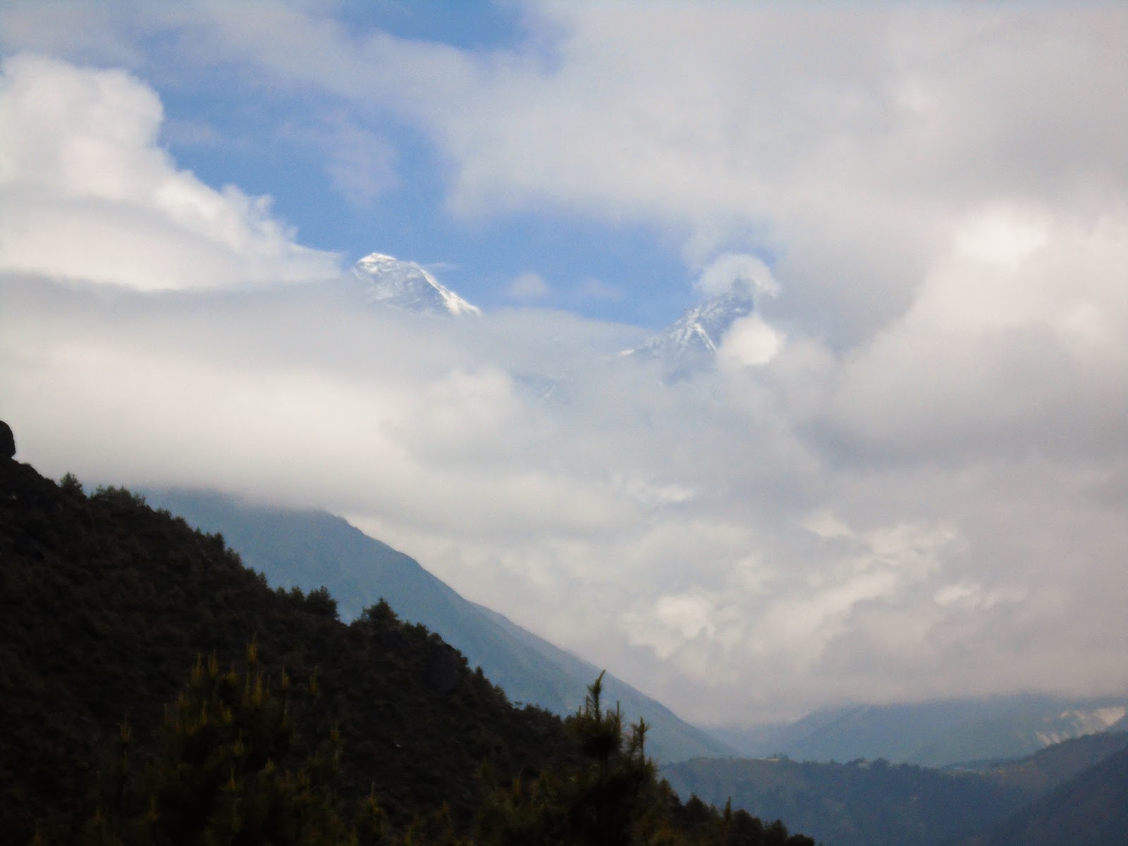
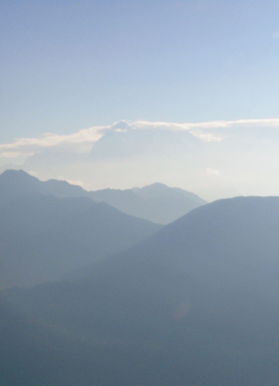
We walked up to the Sagarmatha Visitor Center, (Sagarmatha is the Nepali name for Everest) and toured around enjoying the Tenzing Norgay Memorial statue (the real MVP), as well as the various boards and displays inside the visitor center. On a sunny day, you can see Everest from this point, however, because of the clouds, we couldn’t see anything. As the clouds were beginning to move and disperse slightly, we decided to hang out on top of that hill to wait and see if the clouds would part enough to see Everest. After about 10 minutes of waiting, we could finally see Lhotse peering from behind the clouds, and moments later, Everest. I literally cried. I had been waiting for this moment for so long. to finally see Everest in person! I realized this was no longer a dream, but totally real. Despite being unbelievably sick, I had a rush of adrenaline.
DAY 4: NAMCHE TO DEBOCHE- 3,440m (11,283′) to 3,820m (12,529′)- 6/2/18
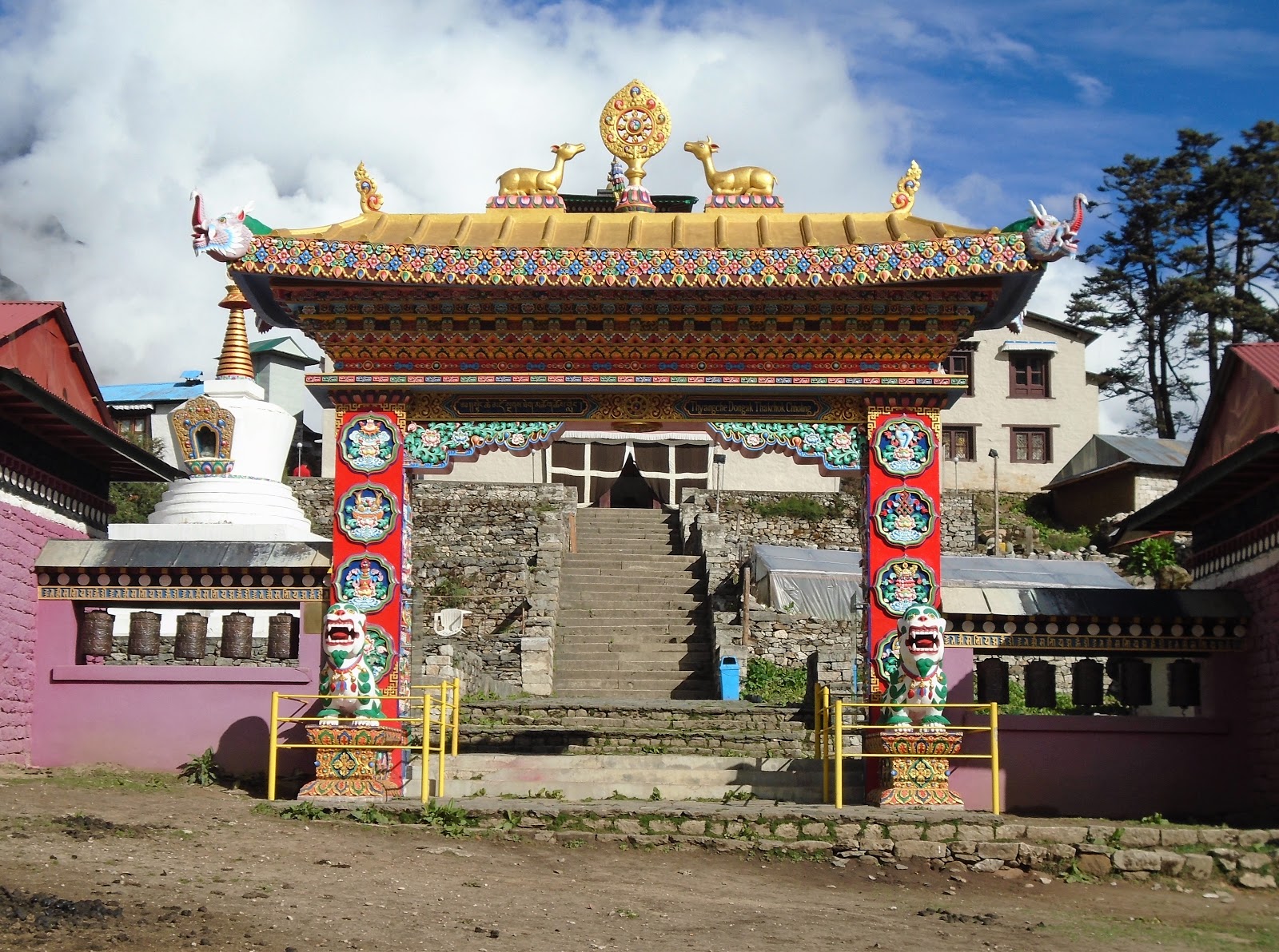
Feeling slightly better the next morning, We set off on our way to what was originally going to be Tengboche. We hiked down a steep hill to the small village of Phunke Tenga near the river, then back up another steep hill to Tengboche and the Tengboche Monastery. We toured the grounds, taking in the beautiful artwork inside the monastery. I absolutely LOVED the detail and the colors. It was very warm and inviting. I only wish we had been there for a Puja ceremony. That would have been incredible to see.
Then came time to find our lodge. Due to the fact that we were trekking in “off season”. Many teahouses close as families head to Kathmandu for the summer. The teahouse we meant to stay in was closed, so we hiked down into the rhododendron forest to the small village of Deboche. The bright colors of the flowers were incredible! Pinks, yellows, and white, colored the trees and the ground.
DAY 5: DEBOCHE TO DINGBOCHE- 3,820m (12,529′) to 4,410m (14,464′)- 6/3/18
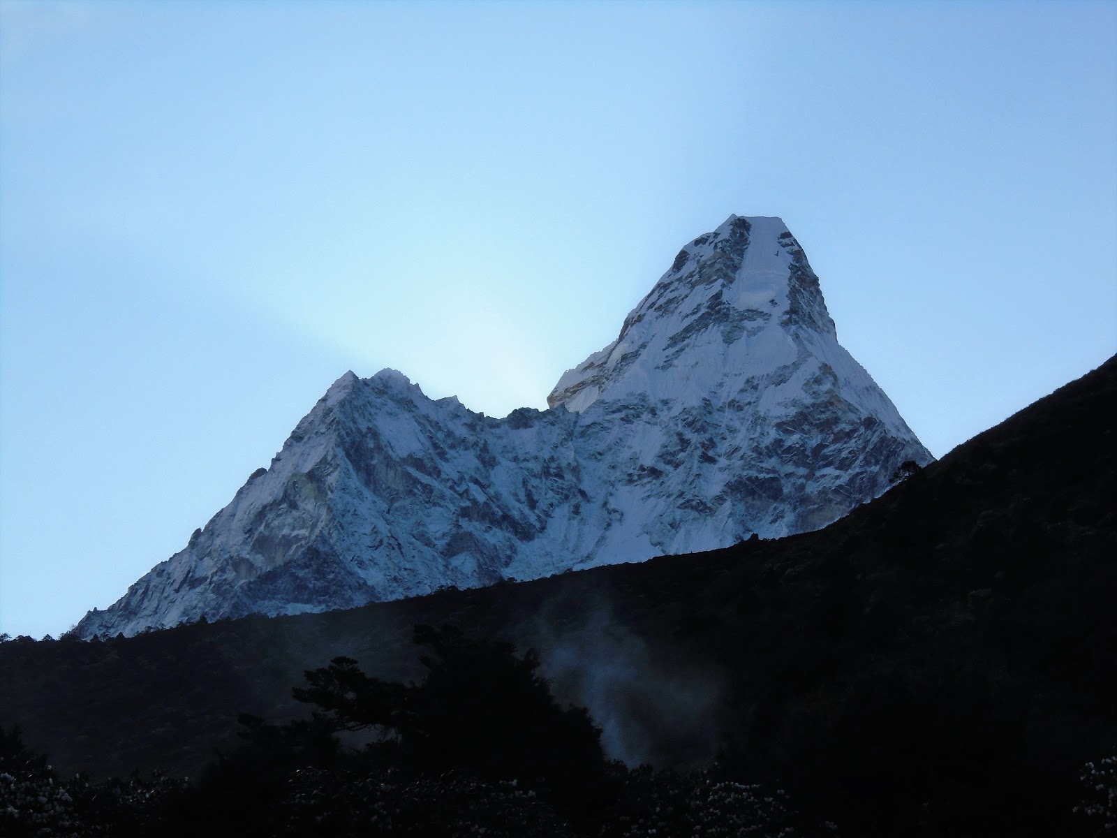
We woke up to a beautiful view of Ama Dablam as well as Everest, Nuptse and Lhotse. The hike was fairly gentle in incline compared to the steep hills I had been climbing before. What was predicted to be a 5-6 hour hike, we did in 4 1/2! At this point in time, I was officially the highest I have ever been. at 14, 464′ I was higher than any peak in Colorado, higher than Mount Rainier, and almost as high as Mount Whitney, the tallest mountain in the contiguous United States at 14,505′. But, it didn’t feel like I was over 14,000′. I was acclimatizing very well and my stomach was improving.
DAY 6: DINGBOCHE TO LOBUCHE (My favorite day)- 4,410m (14,464′) to 4,910m (16,104′)- 6/4/18
Words cannot describe the awe, beauty, and spiritual nature of what I had seen this day… I like to think that I have a very good eye for pictures, especially outdoors, and I still don’t think I did it any justice. I came here, not only to reach a lifelong goal, but to also go on a spiritual pilgrimage of sorts and this day fulfilled a big part of that spiritual side.
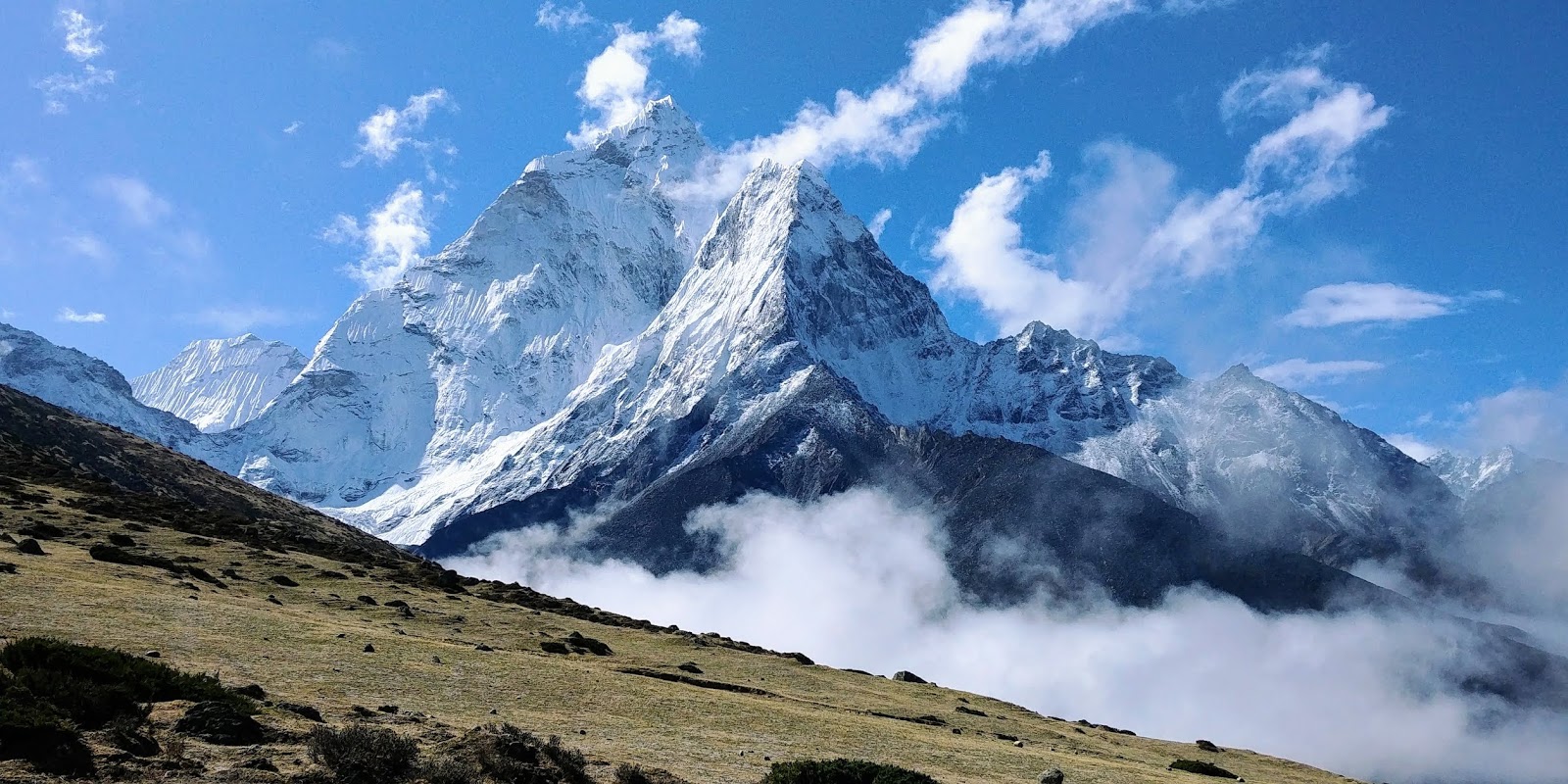
To start, we climbed up the tundra hills above Dingboche. The clouds parted and we had 360 degree views of the Himalayan peaks that surrounded us. I am officially convinced that Ama Dablam is the most beautiful mountain in the world. Everest may the the highest, but it’s not “pretty”. Ama Dablam was stunningly gorgeous. I literally stopped and told myself “don’t sit down or you will never leave.” We took our time in those hills taking dozens of photos. The clouds sweeping by below us added an element like we really were in heaven. I have never seen anything more beautiful in my life.
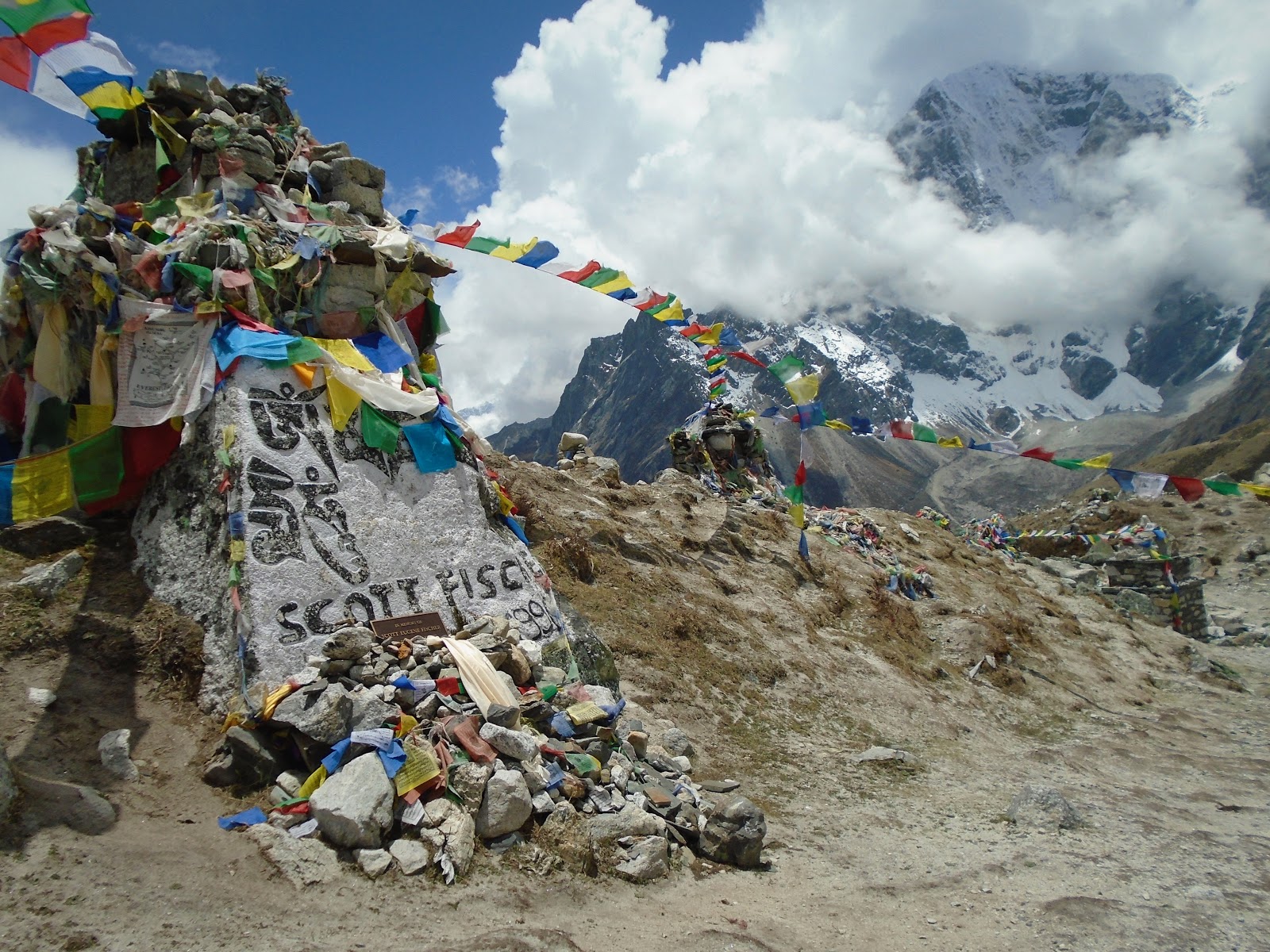
After a quick lunch in Tulkla, we climbed a steep rocky hill to the Sherpa Memorial field where tombstones and stupas of climbers who died on Everest and other nearby peaks cover the hillside to remember those who have fallen. The spirit of this mountain is unreal. You could really feel how sacred of a place this had become.
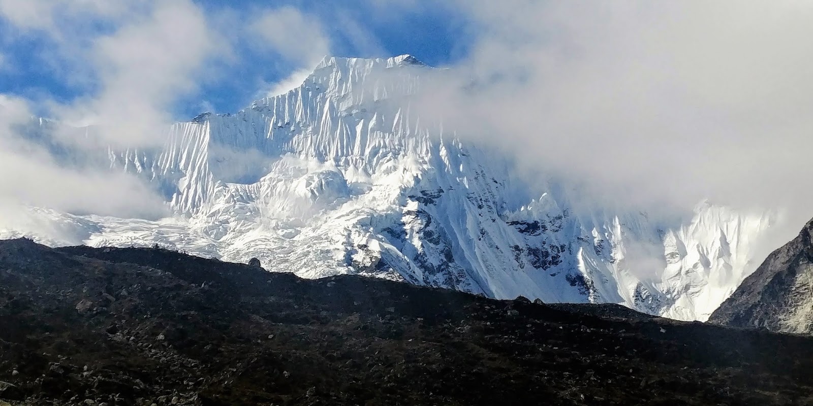
Walking onward, the view opened up to the Khumbu region where Pumori dominated the view, Nuptse stood out infront of Everest, and You could see over the ridge into Tibet where Changtse is visible at 7,543m (24,747′). (You can literally see China!)
DAY 7: LOBUCHE TO GORAK SHEP AND EVEREST BASE CAMP!- 4,910m (16,104′) to 5,140m (16,859′) and 5,464m (17,600′)- 6/5/18

My lungs were definitely beginning to feel the lack of oxygen but my body felt like a freaking amazon warrior! Hung out at base camp for over an hour, playing around in the glacier and I was amazed at how well I felt. From Lobuche, we walked along a fairly flat path to Lobuche Pass which led to the surprisingly intense Changri Glacier crossing. Navigating the crazy rocks was all over the place. Finally, we made it to Gorak Shep, where we would be spending the night.
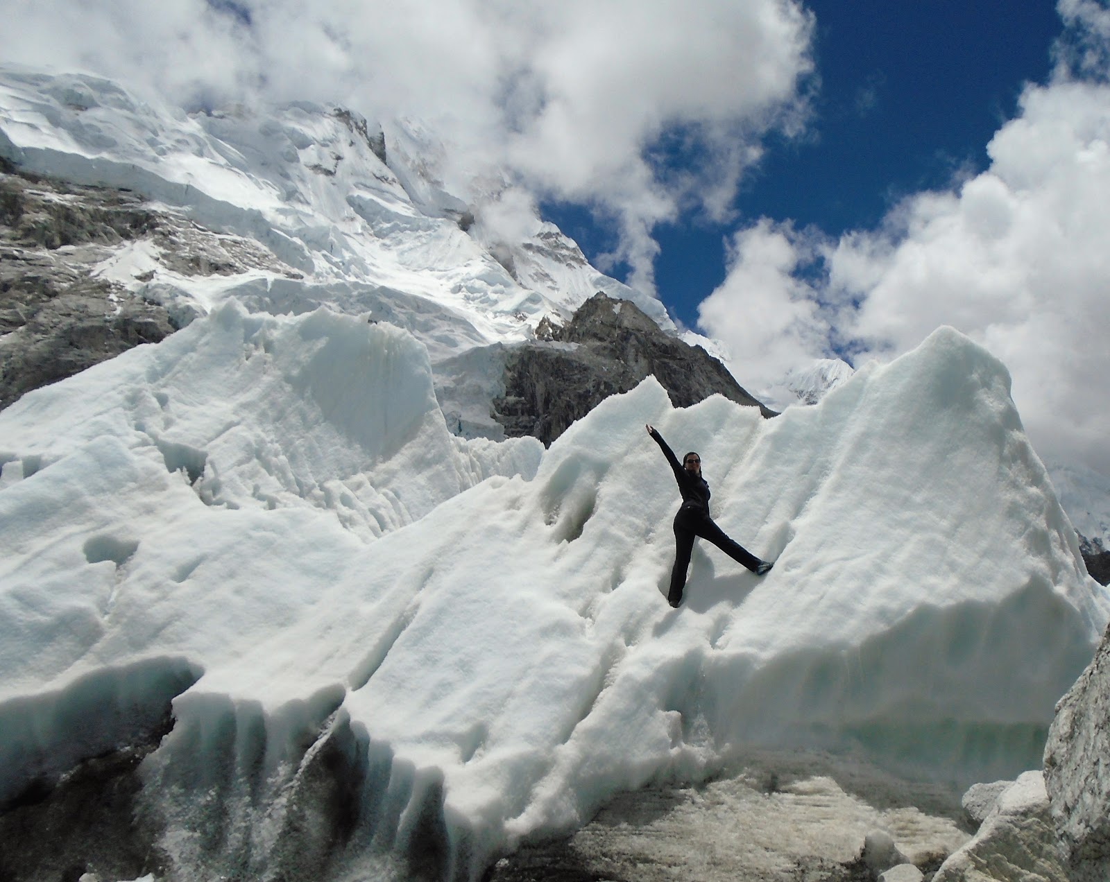
After a quick cup of tea and dropping off our bags, we continued onward to Base Camp. Nuptse dominated our views and it was massive. The tip of Everest’s summit was peering out behind it, and below it all was the Khumbu Glacier. A mix of rocks and ice, like nothing I had ever seen before. We could hear shifting, creaking, and cracking as if the mountain was alive, trying to speak.
When we arrived at EBC, it was like a playground of ice and rock. Climbing season is over so it was completely empty and there were no tents left, but I can imagine sleeping on the wet rocks and having the ice and water constantly moving beneath you. How do you sleep?! The Khumbu Icefall is MASSIVE. in photos, movies, and documentaries don’t show how steep it really is.
After Playing in the glacier, we headed back to Gorak Shep to rest, and get some sleep before our early morning ahead of us.
DAY 8: KALA PATTHAR SUMMIT AND BACK TO DINGBOCHE- 5,644m (18,519′)- 6/6/18
The morning started out very cloudy and socked in. We started climbing Kala Patthar at 5am from Gorak Shep. I hit a wall pretty early into my climb. It was incredibly steep and the lack of oxygen was finally catching up with me in the sense that I would begin to feel a sense of panic whenever I had trouble catching my breath. I would have to stop, calm down, and let my breathing regulate. Part of me wanted to turn back on multiple occasions because of the crappy weather. I didn’t want to make it to the summit and not be able to see the view. But I kept pushing and near the end, I was having to take nearly 10 breaths for every step I took.
Luckily, during the last 20 meters or so to the summit, all of the sudden the clouds began to open up and I managed to see an amazing view of Everest, Nuptse, and the Khumbu Glacier just long enough for a few photos before the clouds closed back in on us. I was exhausted, and out of breath but glad I completed my goal. I had finally seen Everest and Base Camp, and that’s when it began to sink in that I didn’t think that I had it in me for another summit. Island Peak was a bonus, an add-on to my original goal and at this point, I felt like I bit off more than I could chew with my first trip to the Himalayas. I was exhausted, hungry, homesick, and really just kind of done at this point of the trip. I no longer had the desire or even felt the need to climb Island Peak anymore. However, we were headed in that direction anyway, so I kept it in the back of my mind, and was still open to the possibility. After Kala Patthar, we ate breakfast at Gorak Shep then headed all the way back down to Dingboche. A long day for sure, but it was nice to breathe the thicker air.

DAY 9: DINGBOCHE TO CHUKKUNG- 4,410m (14,464′) to 4,730m (15,514′) 6/7/18
My second bout of food poisoning began this morning. I woke up feeling a little nauseous, had trouble eating breakfast, but not thinking much of it initially. but as we began our ascent to Chukkung, it hit me like a wall. I thought I was gonna puke. Was it the vegetables in the spring rolls I had for dinner? or the hot chocolate I had before bed? Either way, I was back to boring foods… Despite wanting to throw up with every step, The hike to Chukkung was pretty short. I spent the rest of the day in bed, trying to let my stomach subside, and then it was time to make a decision. The next day we were supposed to head to Island Peak Base Camp, but I had the option of staying behind while Juan and Gadul joined another guide to make a summit attempt. I felt weak, burned out, sick enough that it seemed like the right decision.
DAY 10-11: WAITING IN CHUKKUNG- 6/8-9/18
The boys left at around 9:30am for base camp which was actually fairly late. We spent the morning waiting out heavy rain before they decided to leave. My stomach was still a mess, and I was still struggling to force down any food. Entertaining myself all day was a struggle, and by the time I went to bed, the doubt began to creep in… “Should I have just gone and tried? Am I giving up?” I had to remind myself how sick and weak I really had become. Even Gadul mentioned he could tell I had lost a lot of weight, and was worried. There is no way I would’ve been able to endure a 16 hour high altitude climb in the condition I was in. By morning the next day, I could FINALLY see Island Peak. towering 5,000 feet above me was a giant wall of ice. I confirmed with myself, there was absolutely no way. Reports from Gadul and Juan talked about waist deep snow from the night before and hidden crevasses EVERYWHERE under the snow. Due to the late season conditions, melting was causing the route to be extremely unsafe, especially near the end so they turned around about 200 meters or so from the summit.
DAY 12-16: DOWN WE GO- 6/10-14/18
The downward crawl had long days. Both Juan and I reminisced on foods we missed back home and miles seemed stretched as our tired legs headed back down from Chukkung to Deboche, Deboche to Namche, and Namche to Lukla. We then spent the next 3 days in Lukla due to weather. We were scheduled to fly out on the 13th, but no planes came at all that morning. We then booked new tickets for the next day in a second attempt however, weather closed in quickly and before our plane was scheduled to take us back to Kathmandu.
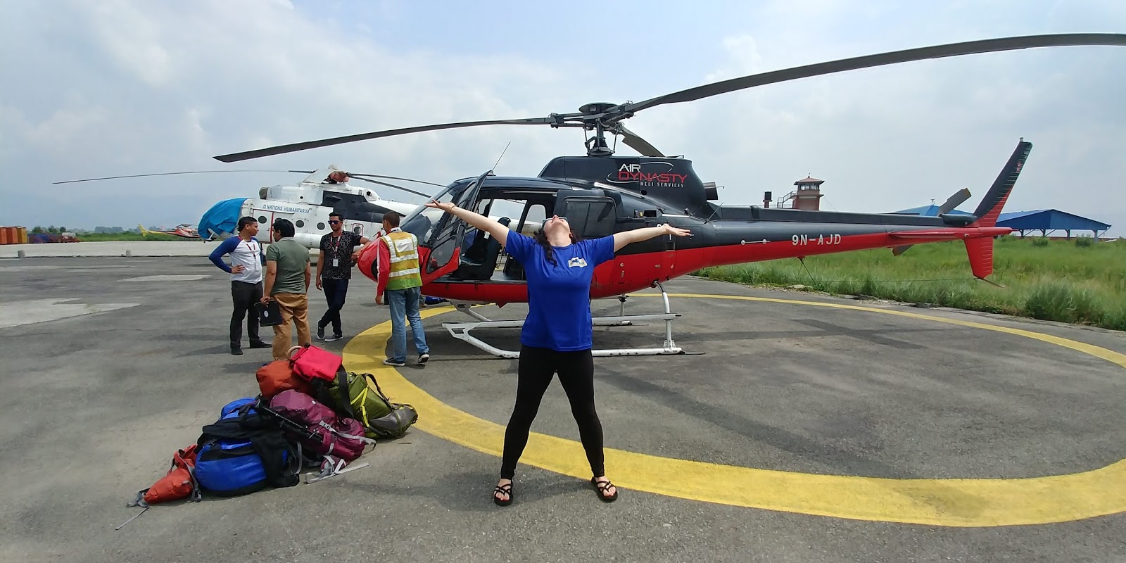
I was scheduled to fly home the next day, and after checking the weather for Friday, it was safe to assume no flights would come the next morning so we looked at our second option: paying $500/person to fly on a helicopter. We decided to go for it, and even that was an anxious waiting game as clouds were even to thick for the helicopter much of the day. They were finally able to land to pick us up and take us back to Kathmandu. It was worth it.
Overall, I loved Nepal. I loved the culture, the people, the mountains, and I would do it again in a heartbeat. It had it’s ups and downs, but for a first trip to the Himalayas I felt like it was a successful endeavor. I hope you enjoyed my long winded report. I know it was a lot to read through. Be sure to read What I learned About Myself In Nepal as well!

One thought on “TRIP REPORT: Everest Base Camp (17,600′)/ Kala Patthar (18,519′)”